• 3 Mile Walks or Less
  • 4 Mile Walks
  • 5 Mile Walks
  • 6 Mile Walks
  • 7 Mile Walks
  • 8 Mile Walks
  • 9 Mile Walks
  • 10 Mile Walks
  • 11 Mile Walks
  • 12 Mile Walks
  • 14 Mile Walks
  • 15 Mile Walks
  • 20+ Mile Walks

The Wandering Wildflower

Peak District Hikes

  • PEAK DISTRICT WALKS
    • SHORT WALKS UNDER 3 MILES
    • MEDIUM WALKS 4-9 MILES
    • LONG PEAK DISTRICT WALKS 10 MILES +
  • PEAK DISTRICT WALKS WITH PUBS
  • PEAK DISTRICT WALKS WITH KIDS
  • HOLMFIRTH WALKS

Coledale Horseshoe – A Lake District Classic Walk | 9 Miles

March 15, 2023 LAKE DISTRICT WALKS

Pinterest pin for Coledale Horseshoe Lake District hiking route by The Wandering Wildflower

The Coledale Horseshoe is a Lake District classic walk. With stunning scenery and 5 Wainwright fells to visit, this should be on your Lake District walks list if you are looking for a full day hillwalking.

A woman looking up at the fells of Crag Hill and Sail

Looking up to a frost topped Crag Hill


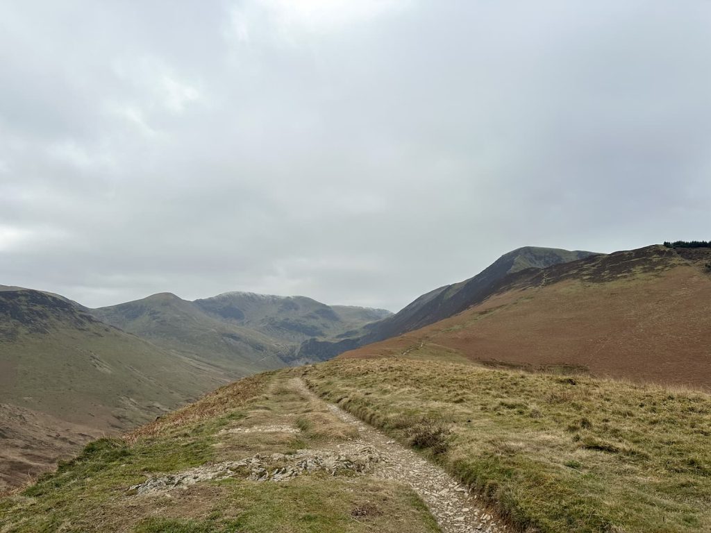
The walk starts from Braithwaite and heads up onto Grisedale Pike before heading round the fells Crag Hill, Sail, Outerside and Barrow, high above the glacial valley of Coledale. The walk itself is 8.6 miles long and also visits some minor fells of Kinn, Hobcarton Crag, Eel Crag and Stile End. There are spectacular views over to Skiddaw and Blencathra, as well as over to Cat Bells, and the route involves a few scramble sections and a ridge walk. This is one of the quieter Lake District horseshoe walks, so perfect if you like a peaceful day on the fells.


Here’s a list of Wainwrights by book.


Where to Park for the Coledale Horseshoe?

We managed to find a parking spot next to the Church of St Bega, St Mungo and St Herbert CA12 5SX. If there are no spaces here, there is a small parking area further up the road or very limited on road parking on the Coledale Road. Please be mindful of local residents and don’t block any passing places.


How Many Wainwright’s are in the Coledale Horseshoe?

There are 5 Wainwrights in the traditional Coledale Horseshoe circuit:

  • Grisedale Pike (791 m)
  • Crag Hill (839 m)
  • Sail (773 m)
  • Outerside (568 m)
  • Barrow (455 m)

We also bagged the following Birketts:

  • Kinn (374 m)
  • Hobcarton Crag (738 m)
  • Eel Crag (807 m)
  • Stile End (447 m)


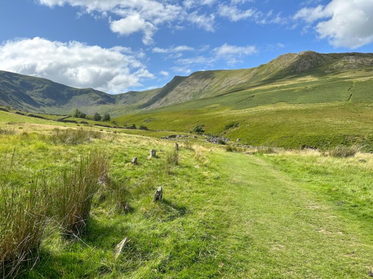
We started in Braithwaite at a small parking area next to the Church of St Bega, St Mungo and St Herbert. From here we crossed the stream next to the colourful bunting, using the rickety bridge and then up through the woodlands, crossing a track. We then made our way (slowly) up the very steep Kinn (374m) and up the well trodden path to the summit of Grisedale Pike.

Looking over to Bassenthwaite from Kinn

A mountain view

A very steep hill!

It’s hard to show just how steep this section was!

A path running along the fells

At one of the false summits, looking up to the actual summit of Grisedale Pike

Grisedale Pike is one of those annoying fells with lots of false summits but the views from the actual summit are pretty special over to Skiddaw and Blencathra, Cat Bells and Walla Crag, and Crag Hill and the towering Grasmoor. There appears to be some horizontal ladder rungs set in the rocky summit – I’ve no idea what these were for but I wonder whether they were something to do with the former mine down in the valley bottom.

Views of fells from the summit of Grisedale Pike

Views over to Hopegill Head with Grasmoor in the distance

A man standing on the summit of Grisedale Pike

Views of the surrounding fells from Grisedale Pike

Looking towards Hobcarton Crag summit

A view of Grisedale Pike summit

Looking back up to Grisedale Pike

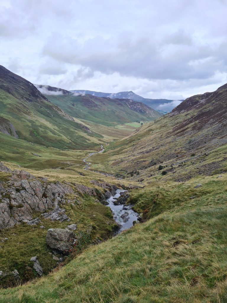
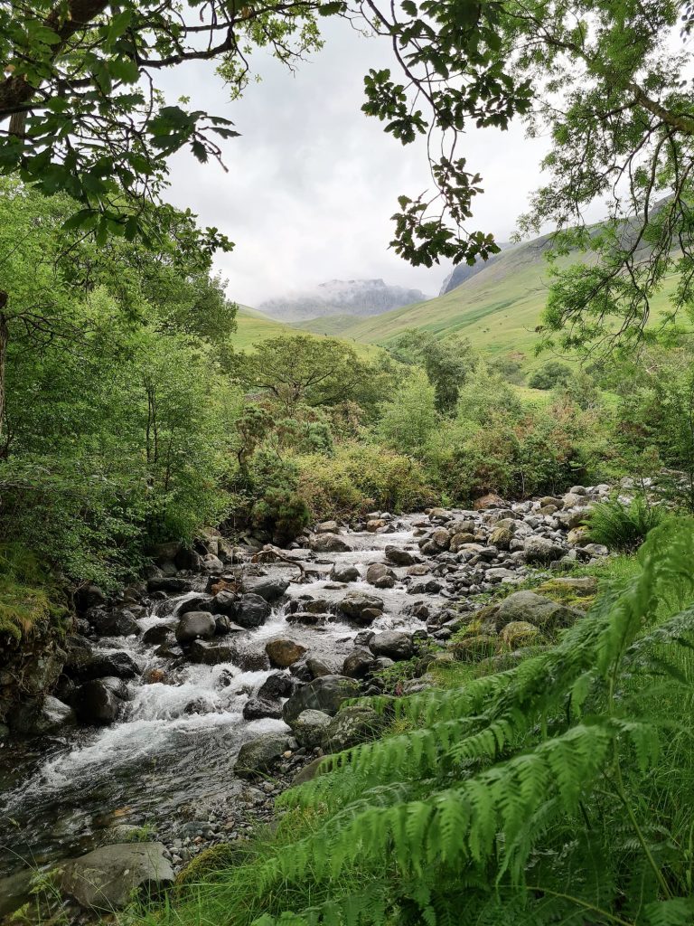
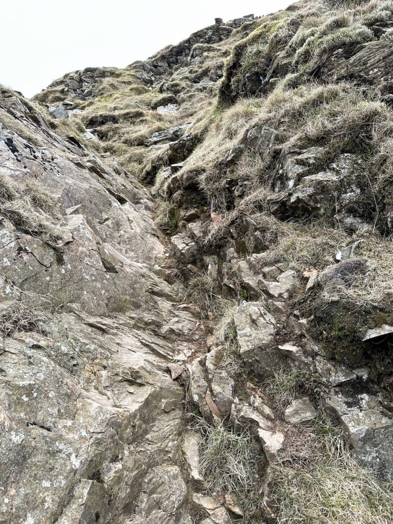
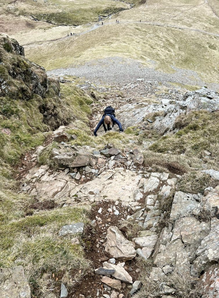
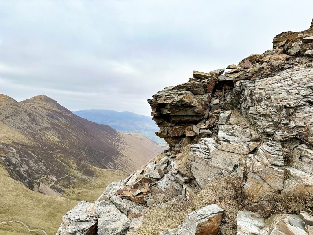
From Grisedale Pike summit we set off over Hobcarton Crag summit towards Coledale Hause, having a rest and a bite to eat next to the waterfalls in Liza Beck. There are two options here to get to the top of Crag Hill – you can follow the path to the south-west which winds its way round the back of the fell, or you can take the direct route and scramble up Eel Crag like we did.

A waterfall near Grisedale Pike

The scramble up Eel Crag

You can just make out the start of the scramble route up, running diagonally from middle right to top left. It then climbs up the nose of Eel Crag.


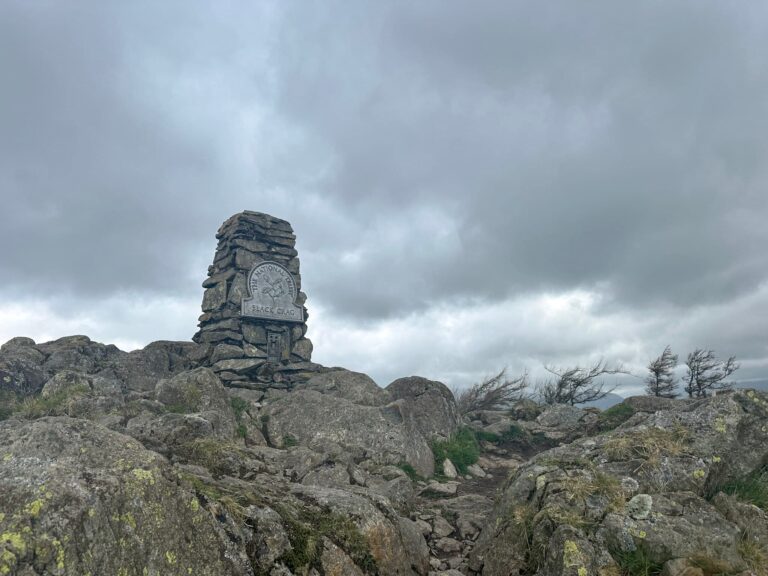
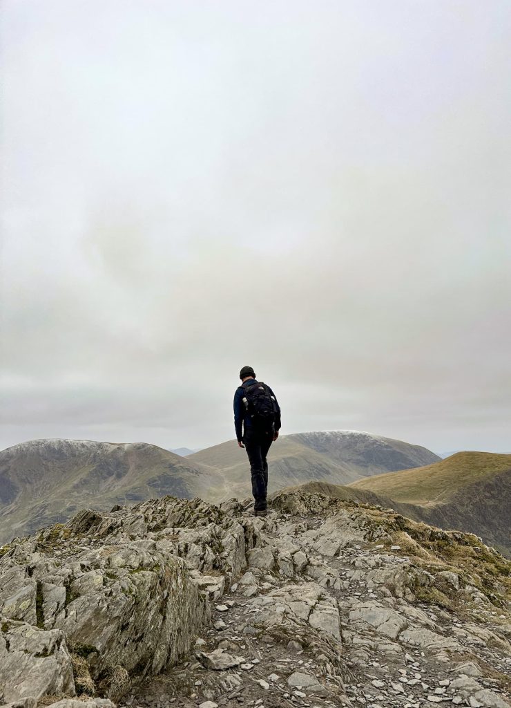
The scramble up Eel Crag isn’t too difficult but you do have to use your hands. It starts out quite scree-ish and then gets rockier as you get up to the top. At the top it’s a grassy climb to the summit of Eel Crag and then onto the top of Crag Hill, marked by a trig point. The views from here down the Coledale Valley are amazing, and the river in the bottom of the valley really does look like an eel.


A view of the scramble on Eel Crag

A woman scrambling up Eel Crag

A young girl scrambling up Eel Crag

A view of the scramble on Eel Crag

Crag Hill trig point

The Crag Hill trig point with views over to Blencathra and Skiddaw


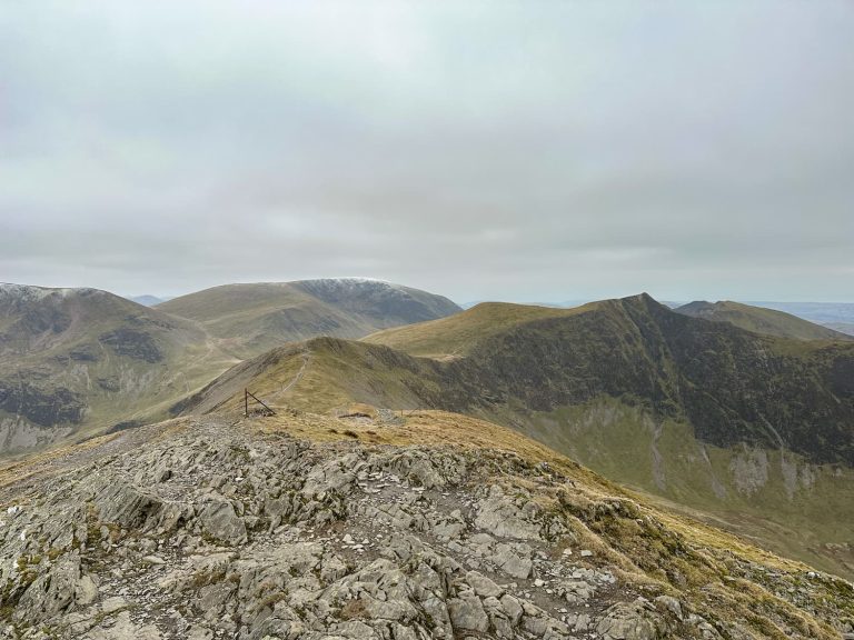
From Crag Hill the path heads over a ridge to Sail, a grassy (and a bit boggy) summit marked by a small cairn of stones next to a puddle. The ridge definitely isn’t as scary as Striding Edge on Helvellyn but might be a bit tricky in high winds or bad weather.


The ridge walk between Crag Hill and Sail

The ridge walk between Crag Hill and Sail

The summit of Sail, a Lake District fell

The summit of Sail

The route from Sail heads down its iconic zig zag path, created to stop footpath erosion, and at the bottom turns left to go down the former mining track north-east towards Outerside. There are a couple of options to get to the summit here – there is an obvious path as you’re coming down from Sail but it’s a bit longer than the short steep route we took up.


A mountain path through the fells leading to Outerside

View of Outerside

View of Outerside


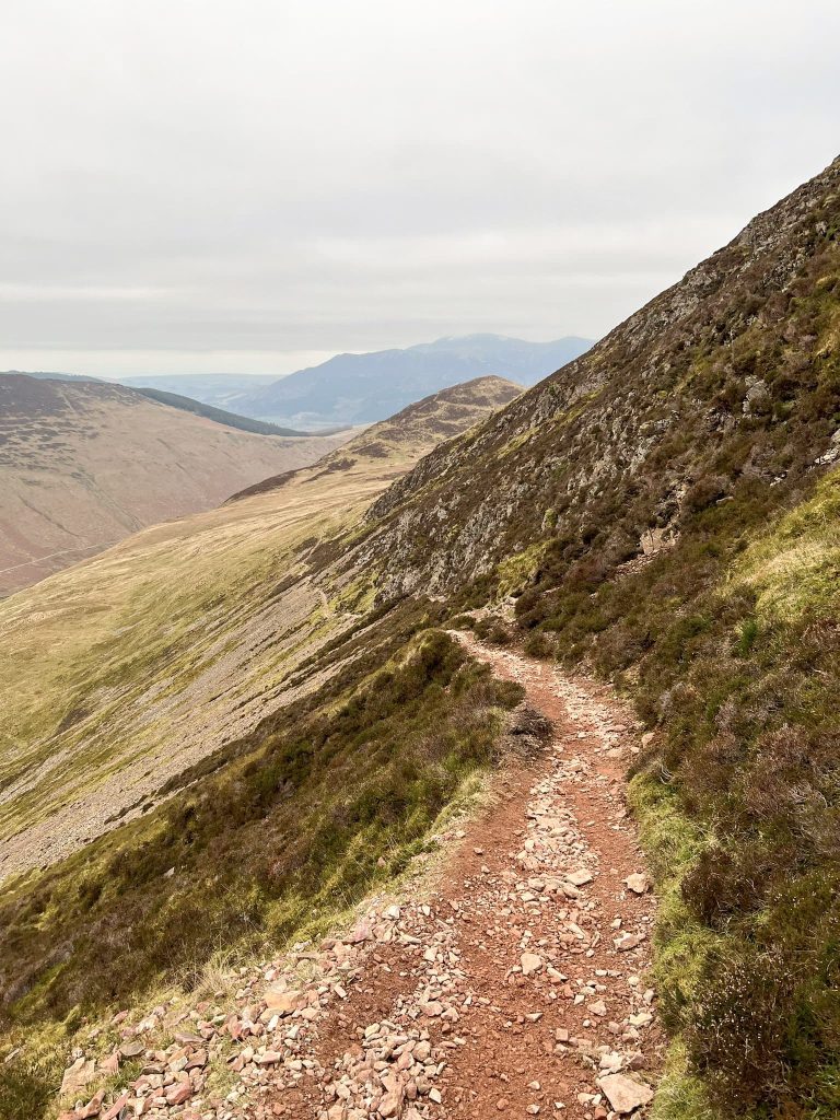
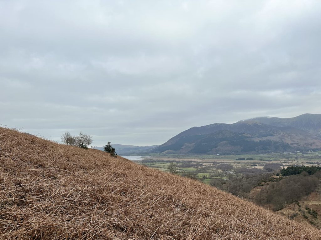
The next summit is Stile End before the path heads up Barrow, a relatively small fell with stunning views down over Derwentwater and Bassenthwaite Lake as well as the Derwent Fells.


View of Stile End and Barrow

View of Stile End and Barrow

The path from Barrow down into Braithwaite is quite steep and grassy, and it didn’t take us long to get down and back to The Coledale Inn for a well deserved pub tea.


Is the Coledale Horseshoe Hard?

I found this a more challenging hike than the Fairfield Horseshoe due to the steep climb up Grisedale Pike. There is a lot of descending and climbing back up along the route as well – it’s definitely not a reservoir bimble. Our route includes a scramble up Eel Crag which should only be undertaken if you’re confident scrambling, and there is a high level ridge walk between Crag Hill and Sail which will be tricky in strong winds.


Coledale Horseshoe Walk Map: 


Walk Map (Opens in OS Maps): The Coledale Horseshoe Walk

Parking: Braithwaite Village CA12 5SX

Facilities: None

Walk Time: 5-6 hours

Difficulty: ▲▲▲

Distance: 8.6 miles (13.84km)

Trig Points Bagged: Crag Hill

Wainwrights Bagged: Grisedale Pike, Crag Hill, Sail, Outerside and Barrow


You might also like:

Fairfield Horseshoe Hiking Route

Helvellyn via Striding Edge

Langdale Pikes Circular

Dash Falls and Skiddaw Walk

Blencathra via Sharp Edge

Tap to share with your hiking friends!

  • Facebook
  • Email
  • WhatsApp
« Peak District Plane Crashes
Bradnop, Moor Top and Hill House Trig Point Walk | 8 Miles »

RELATED POSTS

  • Stickle Tarn with a view of the Jack's Rake scramble up Pavey ArkLangdale Pikes Circular via Jack’s Rake | 8 Miles
  • A view of Gibson Knott on the Greenburn HorseshoeHelm Crag, Gibson Knott, Calf Crag and Steel Fell | 7 Miles
  • A stone market at the Dodd fell summitDodd Fell Summit Trail | 4 Miles
  • A view out of the cave mouth from the insideRydal Cave Walk, Ambleside | 2 Miles

Leave a Reply Cancel reply

Your email address will not be published. Required fields are marked *

FIND YOUR NEXT WALK:

ABOUT ME

Y Garn with Kids - Y Garn via the Devil's Kitchen Walk in Ogwen Valley

Hello! I’m Jo! Welcome to The Wandering Wildflower, an outdoors lifestyle blog focusing on family walks in the Peak District, a place we love exploring. I want to share the Peak District hidden gems and show you there’s so much more than the honeypot places. When I’m not dragging my husband and now 11 year old out on Peak District walks or up mountains, I can be found on planning my next moorland walk or plotting a Geocache walk (and seeing where the nearest pub is!). I love the hills but hate the heights, so trig bagging is – er- fun!


I hope this blog will give you some ideas of places to visit in the Peak District and inspire you and your family to head into the great outdoors.  Thanks for stopping by!

CATEGORIES

  • CIRCULAR WALKS (189)
  • HOLMFIRTH WALKS (27)
  • ISLE OF SKYE WALKS (3)
  • LAKE DISTRICT WALKS (26)
  • LANCASHIRE WALKS (2)
  • LONG PEAK DISTRICT WALKS 10 MILES + (42)
  • MEDIUM WALKS 4-9 MILES (137)
  • PEAK DISTRICT SCRAMBLES (16)
  • PEAK DISTRICT WALKS (206)
  • PEAK DISTRICT WALKS WITH KIDS (76)
  • PEAK DISTRICT WALKS WITH PUBS (60)
  • SCOTLAND WALKS (6)
  • SHORT WALKS UNDER 3 MILES (40)
  • SNOWDONIA WALKS (5)
  • UK CAMPING (5)
  • YORKSHIRE WALKS (33)

Peak District Walks

List of Peak District Ethels

Peak District Peak Bagging

Peak District Trig Point Challenge

Peak District Walks with Pubs

Peak District Walks with Kids

Beautiful Walks in Holmfirth

Short Walks in the Peak District

Long Walks in the Peak District

AFFILIATE DISCLOSURE

This blog may contain affiliate links through which, at no additional cost to you, I may earn a small commission. I only recommend products I would use myself and all opinions expressed here are my own. As an Amazon Associate I earn from qualifying purchases. Read full privacy policy here.

ARCHIVES

PEAK DISTRICT WEATHER

Peak District mountain weather on Met Office

Peak District Trig Points

Promo image for a blog post about the Peak District Trig Point Challenge With Map of Peak District Trig Points and Walking Routes by The Wandering Wildflower

Peak District Ethels Challenge

Promo image for a blog post about the Peak District Trig Point Challenge With Map of Peak District Ethels and Walking Routes by The Wandering Wildflower

WALKING ROUTES STRAIGHT TO YOUR INBOX

Want new walks in your inbox? Drop your email below and I'll send you some ideas for walks you can try.

You can unsubscribe anytime. For more details, review our Privacy Policy.

Thank you!

You have successfully joined our subscriber list.

RSS LATEST POSTS

  • How to Find Three Shires Head
  • Peak District Pub Walks
  • Burnbank Fell, Blake Fell and Gavel Fell | 8 Miles
  • Bretton Park Circular Walk | 3 Miles
  • Grasmere Weekend Break

FOLLOW ON PINTEREST

Want new walks in your inbox? Drop your email below and I'll send you some ideas for walks you can try.

You can unsubscribe anytime. For more details, review our Privacy Policy.

Thank you!

You have successfully joined our subscriber list.

jo@thewanderingwildflower.co.uk

The Wandering Wildflower

  • Email
  • Facebook
  • Instagram
  • Pinterest
  • PRIVACY POLICY
  • TERMS & CONDITIONS
  • ABOUT

(c) The Wandering Wildflower. All Rights Reserved.

|| THEME BY ECLAIR DESIGNS