• 3 Mile Walks or Less
  • 4 Mile Walks
  • 5 Mile Walks
  • 6 Mile Walks
  • 7 Mile Walks
  • 8 Mile Walks
  • 9 Mile Walks
  • 10 Mile Walks
  • 11 Mile Walks
  • 12 Mile Walks
  • 14 Mile Walks
  • 15 Mile Walks
  • 20+ Mile Walks

The Wandering Wildflower

Peak District Hikes

  • PEAK DISTRICT WALKS
    • SHORT WALKS UNDER 3 MILES
    • MEDIUM WALKS 4-9 MILES
    • LONG PEAK DISTRICT WALKS 10 MILES +
  • PEAK DISTRICT WALKS WITH PUBS
  • PEAK DISTRICT WALKS WITH KIDS
  • HOLMFIRTH WALKS

Helvellyn via Striding Edge | 8 Miles

October 15, 2022 LAKE DISTRICT WALKS

Pinterest image for Helvellyn via Striding Edge and Swirral Edge - The Wandering Wildflower

One of the must-do Lake District hikes has to be Helvellyn via Striding Edge. It’s been on our to-do list for some time now, and this past weekend we managed to head up to Glenridding and get the walk done.

Striding Edge - The Wandering Wildflower

Looking back along Striding Edge

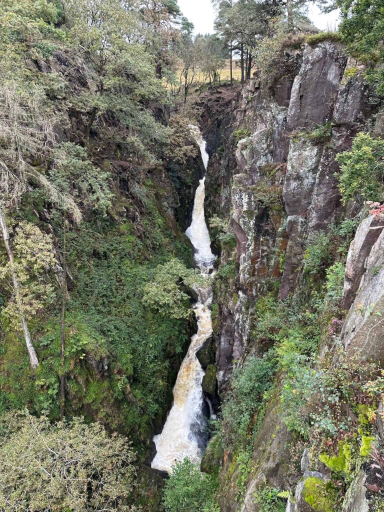
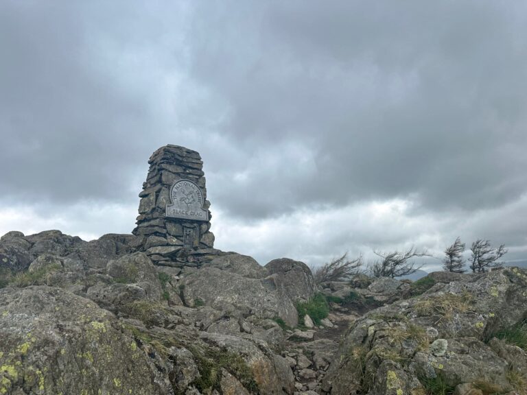
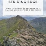
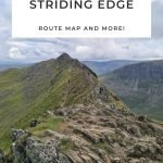
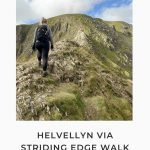
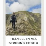
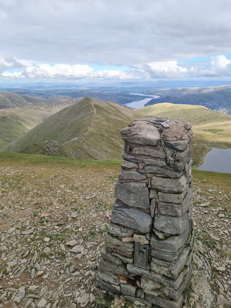
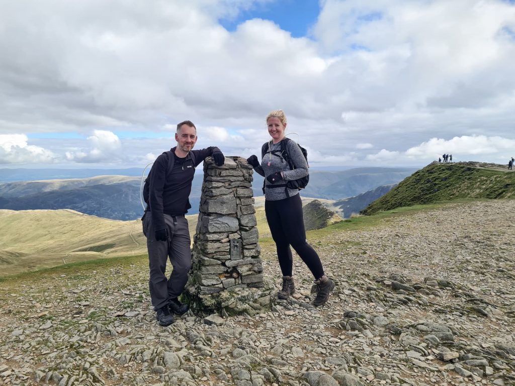
The summit of Helvellyn is 950m above sea level and is marked by the second highest trig point in the UK (the highest is Scafell Pike). There are amazing views down over Red Tarn (and in all directions on a clear day). Helvellyn has two ridges, Striding Edge and Swirral Edge, which surround Red Tarn.


This Helvellyn walk has sat on our list for a while because of how tricky Striding Edge is. Whilst it’s only a Grade 1 scramble, the levels of exposure make this a challenge. We needed to wait for a day when the weather was perfect with low winds (and when we didn’t have other plans!), especially as we took Holly with us.

A view of Helvellyn and Striding Edge - The Wandering Wildflower

Striding Edge as seen from the approach. It doesn’t look that bad from here…

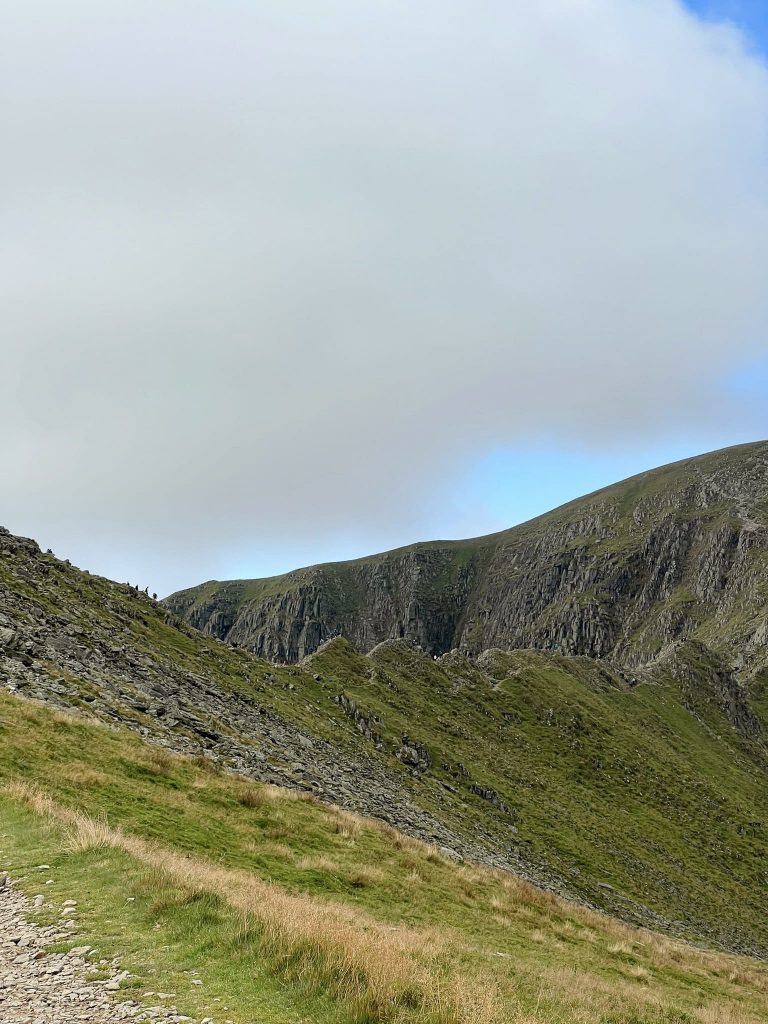
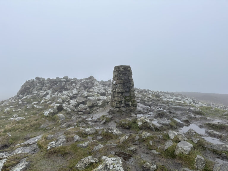
Our walk started at Helvellyn Base Camp at Glenridding Common. We set off past the Gillside Campsite and followed the path over Little Cove. It’s a very steep climb up, with the path being made up of steps and gravel/scree parts. We had a detour to the summit of Birkhouse Moor, which is marked by a cairn and has amazing views down over Ullswater.

Walking up Helvellyn - - The Wandering Wildflower

Birkhouse Moor summit - The Wandering Wildflower

It’s hard to tell from here but she’s racing me to the cairn!

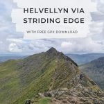
From Birkhouse Moor we rejoined the main path and had a quick lunch stop at Hole-in-the-Wall. After lunch with a view of Helvellyn and Red Tarn, we set off over Low Spying How and came to the start of one of the most famous Lake District scrambles, Striding Edge.

Helvellyn and Striding Edge - The Wandering Wildflower

A crowd at the start of Striding Edge - The Wandering Wildflower

A queue waiting to cross Striding Edge. Most people were patient and happy to wait for others to get across.

Looking along Striding Edge - The Wandering Wildflower

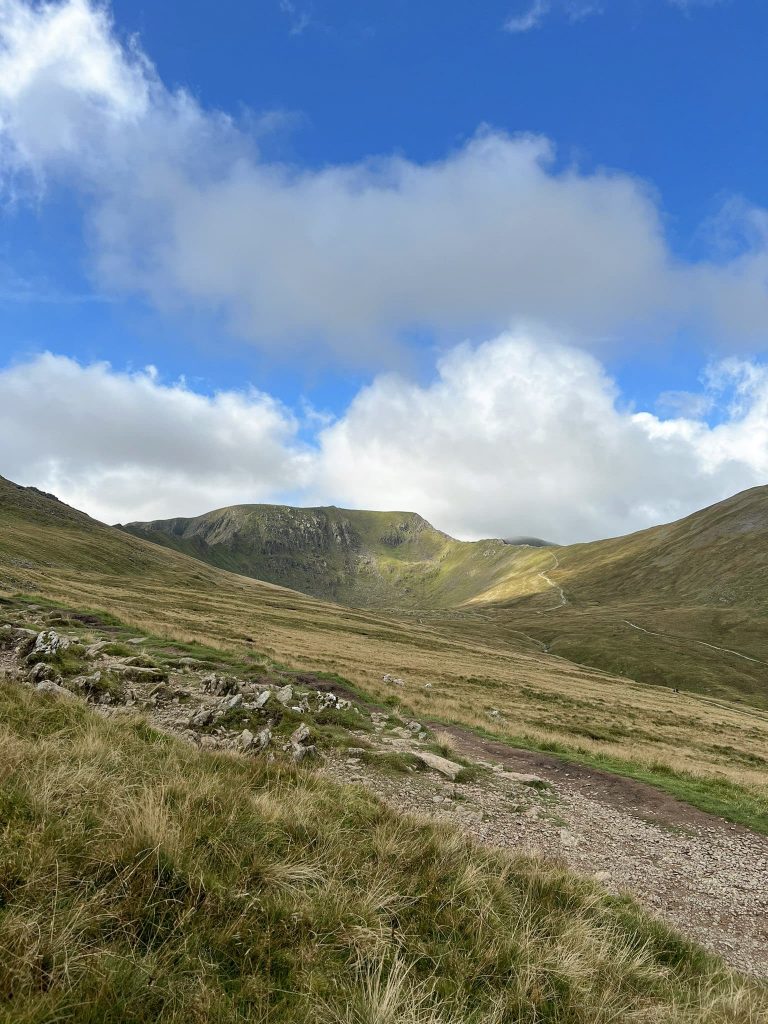
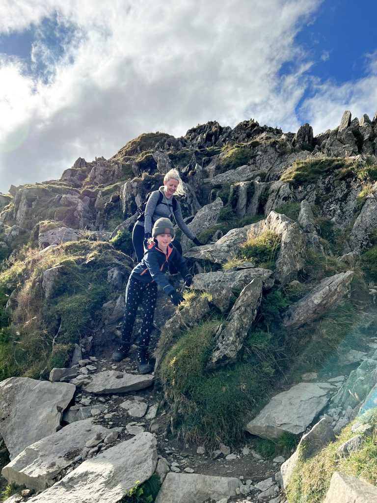
Striding Edge has a bit of a reputation for being dangerous in poor conditions, and it’s definitely something that you shouldn’t underestimate. Whilst it’s a Grade 1 scramble, it is very exposed and narrow, and can be really busy in good weather. There are sections where you have to climb down and the terrain is rough. There are plenty of sections where you have to climb using your hands – it’s not a simple wander along. After you have crossed the main ridge there is a steep climb up onto Helvellyn itself.


There is a path which runs at a slightly lower level so if you find the ridge too challenging or it’s too windy, you can drop down to the path and still head up to Helvellyn this way. You’ll still have the climb up onto the summit itself but you’ll avoid the ridge walk.

People climbing down Striding Edge - The Wandering Wildflower

A short steep climbing section, best done facing outwards away from the rock but it means you can see the drop down… This is where one lady got scared and was stuck for a few minutes.

Looking along Striding Edge - The Wandering Wildflower

Looking back to the sharp drop section just passed.

Striding Edge - The Wandering Wildflower

Looking ahead to the climb up onto Helvellyn summit – it’s very steep and we had to use our hands to climb up.

Helvellyn Trig Point and the view - The Wandering Wildflower

Helvellyn trig point and the view - The Wandering Wildflower

A couple posing with Helvellyn trig point - The Wandering Wildflower

Adjoining Helvellyn is another ridge, Swirral Edge. This is shorter than Striding Edge but is again very narrow and exposed. It’s another Grade 1 scramble where you have to use your hands, and there are sharp drops down either side.

Swirral Edge - The Wandering Wildflower

Descending Swirral Edge with a view over Brown Cove to the left

Descending Swirral Edge - The Wandering Wildflower

When we’d scrambled down Swirral Edge, we headed back down the path back towards Hole-in-the-Wall and crossed the stile before following the path back down Grisedale Brow.

Catstycam - The Wandering Wildflower

The path to Catstycam – we took a path to the right to head over to Hole-in-the-Wall again

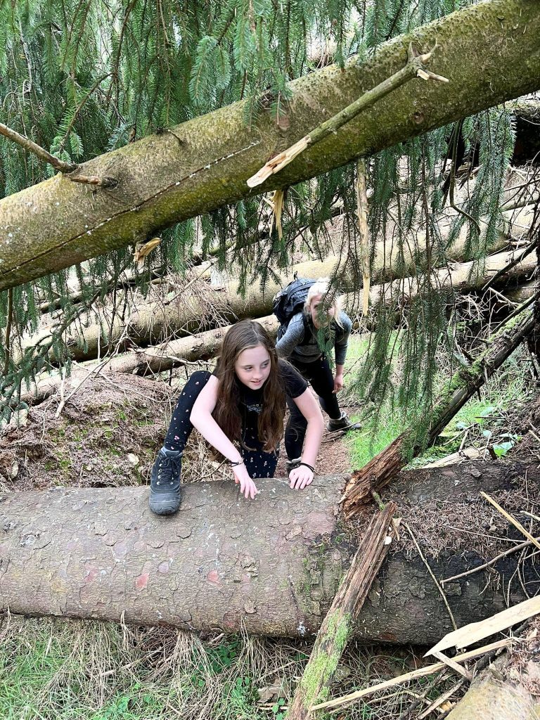
We took a detour which went past Lanty’s Tarn – when we visited, the path was blocked by fallen trees caused by Storm Arwen so we had to do a lot of climbing under and over trees!

Climbing over fallen trees near Lanty's Tarn - The Wandering Wildflower

We soon picked up the main path again and headed back down through the woods into Glenridding, and to The Travellers Rest pub for a late lunch. The Travellers Rest pub is the nearest pub to Helvellyn and does get quite busy at times.


This Helvellyn via Striding Edge walk was one I really enjoyed and we’ll definitely be back to walk some of the other Wainwrights nearby including Catstycam and Nethermost Pike.


Helvellyn Weather

Always check the weather before you go. I use Mountain Forecast to check the weather forecast at the summit as it can differ dramatically from that at ground level. When we set off it was 13 degrees at ground level but dropped to a chilly -1 degrees on Striding Edge. Always check the wind levels as well – this is not a walk to do in high winds!


Is Helvellyn Difficult to Climb?

It really depends – it’s a mountain and therefore not to be underestimated, but whether it’s difficult depends on your own fitness and stamina, as well as the weather on the day. I walk a lot and had a sore leg from the descent of Helvellyn due to the relentless steep descent, but someone fitter than me may find it easier. It’s also hard to say whether Striding Edge is hard – I was really nervous as I’m not good with heights but once I was on and scrambling across, I was absolutely fine. When we did Buchaille Etive Beag I was really scared by the ridge so expected the same this time! There was one lady who was really scared though and a few people with dogs who were scared and had to drop down to the lower path. It’s all down to how well you deal with heights and exposure!


Helvellyn via Striding Edge Route Info:

Helvellyn Route Map:


Walk Map (Opens in OS Maps): Helvellyn via Striding Edge Walk Map

Helvellyn Car Park: Glenridding Common (£8 for the day)

Facilities: Public toilets and cafe at the car park

Walk Time: 6-7 hours depending on speed and fitness

Difficulty: ▲▲▲

Distance: 7.9 miles (12.7 km)

Wainwrights Bagged: Birkhouse Moor, Helvellyn


You might also like:

Fairfield Horseshoe Hiking Route

Langdale Pikes Circular

Coledale Horseshoe – A Lake District Classic Walk

Tap to share with your hiking friends!

  • Facebook
  • Email
  • WhatsApp
« Kirk Edge Trig Point | 4 Miles
Ben Nevis Hike | 10 Miles »

RELATED POSTS

  • A woman admiring the view over Derwentwater from Walla CragWalla Crag, Bleaberry Fell and High Seat | 6 Miles
  • A stone market at the Dodd fell summitDodd Fell Summit Trail | 4 Miles
  • A view over to Lowthwaite Fell from Longlands FellUldale Fells Circular | 8 Miles
  • A view of Gibson Knott on the Greenburn HorseshoeHelm Crag, Gibson Knott, Calf Crag and Steel Fell | 7 Miles

Leave a Reply Cancel reply

Your email address will not be published. Required fields are marked *

FIND YOUR NEXT WALK:

ABOUT ME

Y Garn with Kids - Y Garn via the Devil's Kitchen Walk in Ogwen Valley

Hello! I’m Jo! Welcome to The Wandering Wildflower, an outdoors lifestyle blog focusing on family walks in the Peak District, a place we love exploring. I want to share the Peak District hidden gems and show you there’s so much more than the honeypot places. When I’m not dragging my husband and now 11 year old out on Peak District walks or up mountains, I can be found on planning my next moorland walk or plotting a Geocache walk (and seeing where the nearest pub is!). I love the hills but hate the heights, so trig bagging is – er- fun!


I hope this blog will give you some ideas of places to visit in the Peak District and inspire you and your family to head into the great outdoors.  Thanks for stopping by!

CATEGORIES

  • CIRCULAR WALKS (189)
  • HOLMFIRTH WALKS (27)
  • ISLE OF SKYE WALKS (3)
  • LAKE DISTRICT WALKS (26)
  • LANCASHIRE WALKS (2)
  • LONG PEAK DISTRICT WALKS 10 MILES + (42)
  • MEDIUM WALKS 4-9 MILES (137)
  • PEAK DISTRICT SCRAMBLES (16)
  • PEAK DISTRICT WALKS (206)
  • PEAK DISTRICT WALKS WITH KIDS (76)
  • PEAK DISTRICT WALKS WITH PUBS (60)
  • SCOTLAND WALKS (6)
  • SHORT WALKS UNDER 3 MILES (40)
  • SNOWDONIA WALKS (5)
  • UK CAMPING (5)
  • YORKSHIRE WALKS (33)

Peak District Walks

List of Peak District Ethels

Peak District Peak Bagging

Peak District Trig Point Challenge

Peak District Walks with Pubs

Peak District Walks with Kids

Beautiful Walks in Holmfirth

Short Walks in the Peak District

Long Walks in the Peak District

AFFILIATE DISCLOSURE

This blog may contain affiliate links through which, at no additional cost to you, I may earn a small commission. I only recommend products I would use myself and all opinions expressed here are my own. As an Amazon Associate I earn from qualifying purchases. Read full privacy policy here.

ARCHIVES

PEAK DISTRICT WEATHER

Peak District mountain weather on Met Office

Peak District Trig Points

Promo image for a blog post about the Peak District Trig Point Challenge With Map of Peak District Trig Points and Walking Routes by The Wandering Wildflower

Peak District Ethels Challenge

Promo image for a blog post about the Peak District Trig Point Challenge With Map of Peak District Ethels and Walking Routes by The Wandering Wildflower

WALKING ROUTES STRAIGHT TO YOUR INBOX

Want new walks in your inbox? Drop your email below and I'll send you some ideas for walks you can try.

You can unsubscribe anytime. For more details, review our Privacy Policy.

Thank you!

You have successfully joined our subscriber list.

RSS LATEST POSTS

  • How to Find Three Shires Head
  • Peak District Pub Walks
  • Burnbank Fell, Blake Fell and Gavel Fell | 8 Miles
  • Bretton Park Circular Walk | 3 Miles
  • Grasmere Weekend Break

FOLLOW ON PINTEREST

Want new walks in your inbox? Drop your email below and I'll send you some ideas for walks you can try.

You can unsubscribe anytime. For more details, review our Privacy Policy.

Thank you!

You have successfully joined our subscriber list.

jo@thewanderingwildflower.co.uk

The Wandering Wildflower

  • Email
  • Facebook
  • Instagram
  • Pinterest
  • PRIVACY POLICY
  • TERMS & CONDITIONS
  • ABOUT

(c) The Wandering Wildflower. All Rights Reserved.

|| THEME BY ECLAIR DESIGNS