• 3 Mile Walks or Less
  • 4 Mile Walks
  • 5 Mile Walks
  • 6 Mile Walks
  • 7 Mile Walks
  • 8 Mile Walks
  • 9 Mile Walks
  • 10 Mile Walks
  • 11 Mile Walks
  • 12 Mile Walks
  • 14 Mile Walks
  • 15 Mile Walks
  • 20+ Mile Walks

The Wandering Wildflower

Peak District Hikes

  • PEAK DISTRICT WALKS
    • SHORT WALKS UNDER 3 MILES
    • MEDIUM WALKS 4-9 MILES
    • LONG PEAK DISTRICT WALKS 10 MILES +
  • PEAK DISTRICT WALKS WITH PUBS
  • PEAK DISTRICT WALKS WITH KIDS
  • HOLMFIRTH WALKS

Scafell Pike Route | 6.5 Miles

August 8, 2022 CIRCULAR WALKS, LAKE DISTRICT WALKS

This Scafell Pike route starts from Wast Water and climbs up Lingmell, then Scafell Pike and along to Scafell before heading back down the fells to the car park. This is a challenging 6.5 miles walk – Scafell Pike is the highest mountain in England, with Scafell being the second.

We went camping with some friends and decided to bag another of the National 3 Peaks (we already climbed Snowdon and have plans for Ben Nevis later in the year). This challenging walk also takes in Lingmell and Scafell, and is a lovely day out in the fells. We were a group made up of three 40-somethings and two 10 year olds.


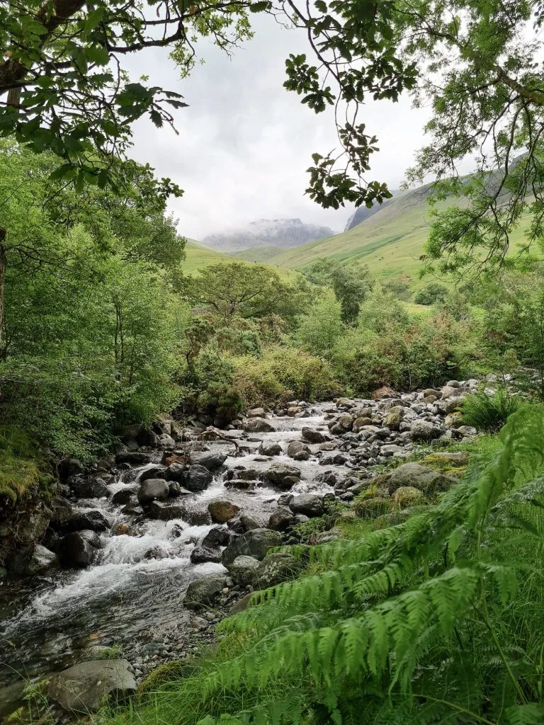
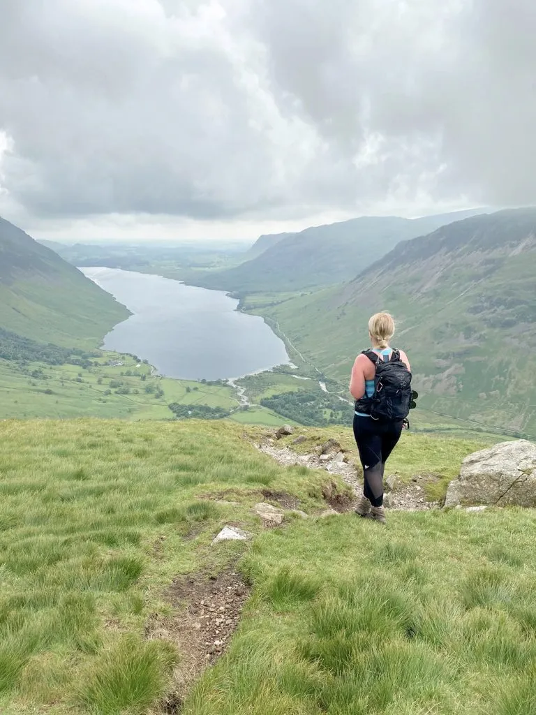
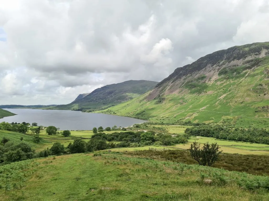
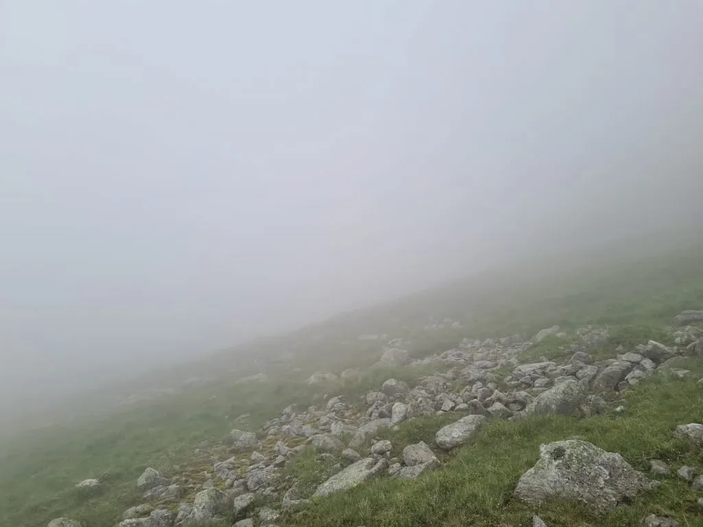
Starting from the car park at Wasdale, we headed along the track and over the bridge to start the ascent of Lingmell. This is pretty much a steep climb right from the start! There are plenty of excuses for a rest though as the view over Wastwater is amazing. It was a good thing we took in the view – as soon as we hit the cloud layer, that was all we saw for the rest of the walk! Yet another Lake District walk with amazing views!


The climb up Lingmell gets slightly more gradual as you reach the top, and it becomes more rocky near the summit, which is marked by a cairn.


From Lingmell we headed south-east towards the summit of Scafell Pike. This is very rocky underfoot but there is a faint path to follow. The path soon joins the main route, and you’ll know when you get nearer to the summit as it will start getting really busy. We barely saw anyone up until the point we joined the main path!

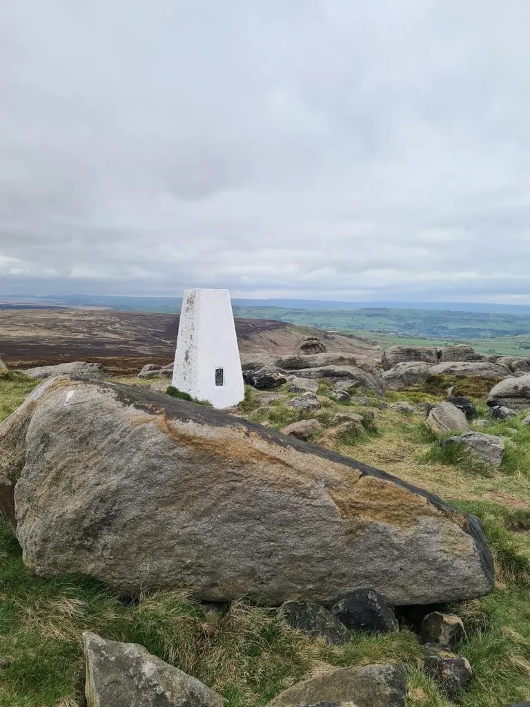
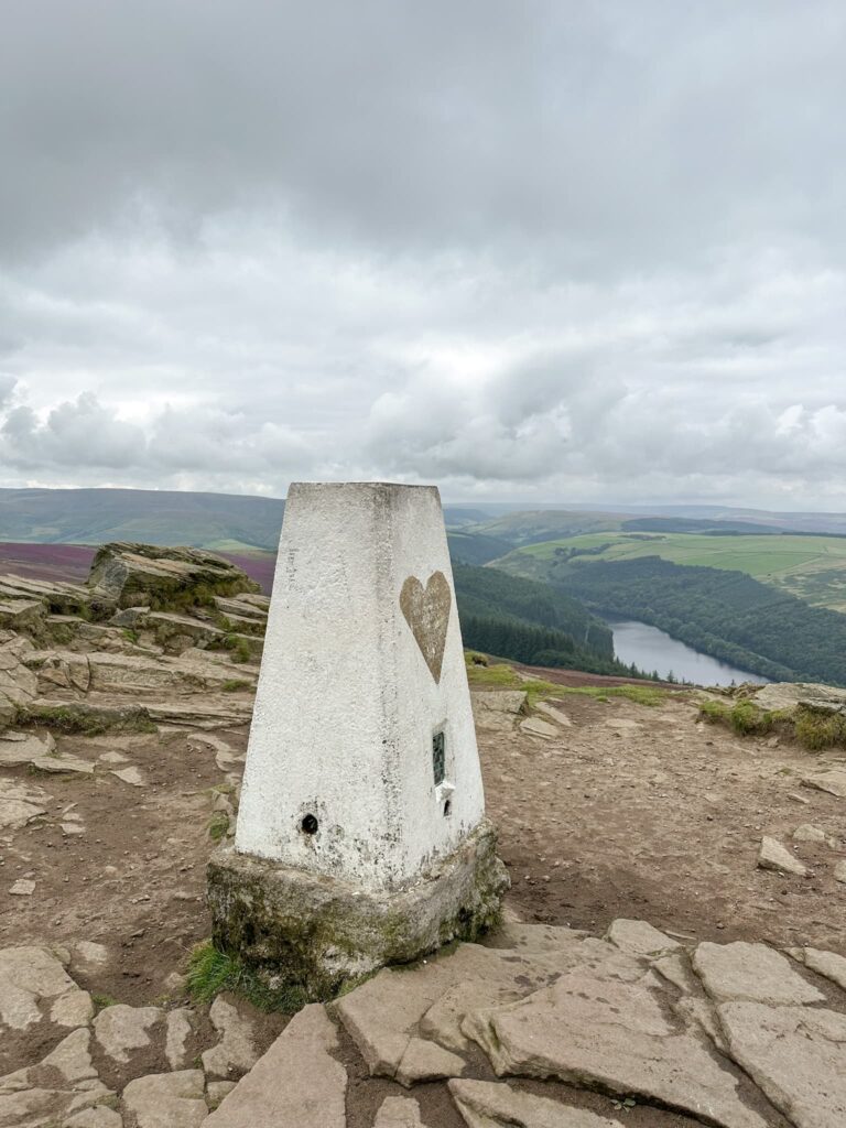
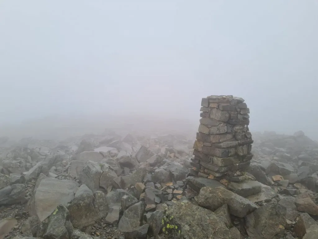
At the Scafell Pike summit there is a trig point and a WW1 memorial, which is higher than the trig point. At one point, Hols and her friend were the highest 10 year olds in England and Wales! They both did amazing to climb Scafell Pike, and we’re super proud of them both.

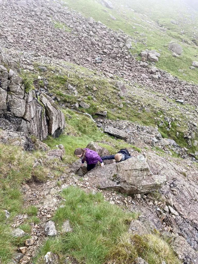
From Scafell Pike we started to descend back down the stony track to Mickledore, past the Mountain Rescue post. Rather than taking two tired 10 year olds up Broad Stand, which is a very challenging ascent of Scafell for anyone but the most experienced scramblers or climbers, we headed down a bit further, past the waterfall and then up past Foxes Tarn. There is still a lot of scrambling to do here, up some rather steep and precarious sections, so this should only be attempted if you are confident with this.

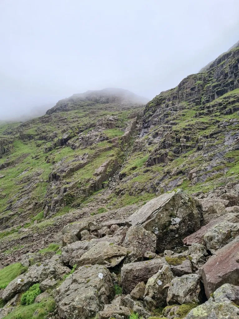
The path will begin to become less steep and you’ll soon reach the top of Scafell which is marked by a small cairn.


From here, we headed east then south-east along Green How, and down the hillside. The paths are really stony and rocky and make the going quite hard. This seemed like a never ending descent and if you suffer with knee trouble, I’d recommend using walking poles for this. The paths are very faint, so it’s a case of just heading in the general direction or following the route on your device.


Eventually you’ll find yourself back on the Old Corpse Road which you can follow back to the car for a well earned rest.


This is a very challenging walk – what it lacks in distance it more than makes up for in height and the up and down nature of it, including scrambling sections. In bad weather this could be quite dangerous so please make sure you are prepared when you go – it’s not a walk to do in Crocs or flip flops. The terrain is very rocky in places so be sure to wear decent walking boots.


Scafell Pike Camping

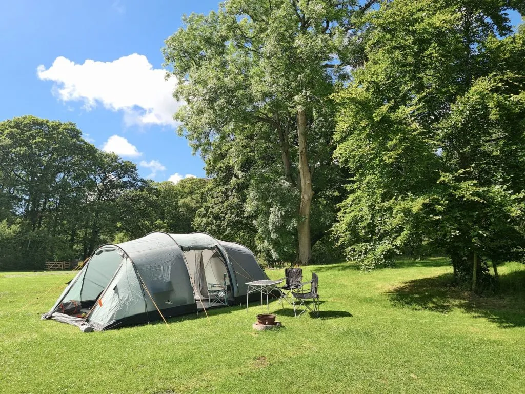
We camped at Fisherground Campsite in Eskdale and would definitely recommend it. Each pitch is pretty big, and they give you a firepit too. There is plenty of space for the kids to play and there is a miniature steam railway that stops right at the camp site. The only downside was the local shop (advertised as being well stocked) wasn’t really well stocked so we had to drive 10 miles to the Coop in Seascale for supplies.

The last outing for our Vango Vista 800 – she leaked like a sieve this time, so she’s been given away to someone who has space to waterproof her properly for another outing! We’ve since bought the Vango Spectre 600 XL.

Scafell Pike Weather

Always check the weather before you go. I use Mountain Forecast to check the weather forecast at the summit as it can differ dramatically from that at ground level.


Scafell Pike Route Info:

Scafell Pike Route Map:


Walk Map (Opens in OS Maps): Scafell Pike from Wasdale Map

Parking: Wasdale Car Park, CA20 1EX. This is a National Trust car park and is pay and display

Facilities: Public toilets and cafe at the car park

Walk Time: 6-7 hours depending on speed and fitness

Difficulty: ▲▲▲

Distance: 6.6 miles (10.6 km)

Wainwrights Bagged: Lingmell, Scafell Pike and Sca Fell


For more walks climbing multiple Wainwrights, you might like:

Dash Falls and Skiddaw Walk

Blencathra via Sharp Edge

List of Wainwrights By Book

Tap to share with your hiking friends!

  • Facebook
  • Email
  • WhatsApp
« Flask Edge and White Edge | 8 Miles
Croker Hill and Bosley Reservoir | 5 Miles »

RELATED POSTS

  • Win Hill trig point at sunriseDerwent Reservoirs Circular (Dambusters Challenge Walk)
  • Thorpe Cloud, DovedaleDovedale and Thorpe Cloud Walk | 7 Miles
  • Black Chew Head and Laddow Rocks Circular from Crowden Camp Site - Solo Hike from The Wandering WildflowerBlack Chew Head via Laddow Rocks Walk | 6 Miles
  • Bleaklow Stones from a walk to Alport Moor in the Peak District by The Wandering WildflowerAlport Moor and Bleaklow Walking Route | 9 Miles

Leave a Reply Cancel reply

Your email address will not be published. Required fields are marked *

FIND YOUR NEXT WALK:

ABOUT ME

Y Garn with Kids - Y Garn via the Devil's Kitchen Walk in Ogwen Valley

Hello! I’m Jo! Welcome to The Wandering Wildflower, an outdoors lifestyle blog focusing on family walks in the Peak District, a place we love exploring. I want to share the Peak District hidden gems and show you there’s so much more than the honeypot places. When I’m not dragging my husband and now 11 year old out on Peak District walks or up mountains, I can be found on planning my next moorland walk or plotting a Geocache walk (and seeing where the nearest pub is!). I love the hills but hate the heights, so trig bagging is – er- fun!


I hope this blog will give you some ideas of places to visit in the Peak District and inspire you and your family to head into the great outdoors.  Thanks for stopping by!

CATEGORIES

  • CIRCULAR WALKS (189)
  • HOLMFIRTH WALKS (27)
  • ISLE OF SKYE WALKS (3)
  • LAKE DISTRICT WALKS (26)
  • LANCASHIRE WALKS (2)
  • LONG PEAK DISTRICT WALKS 10 MILES + (42)
  • MEDIUM WALKS 4-9 MILES (137)
  • PEAK DISTRICT SCRAMBLES (16)
  • PEAK DISTRICT WALKS (206)
  • PEAK DISTRICT WALKS WITH KIDS (76)
  • PEAK DISTRICT WALKS WITH PUBS (60)
  • SCOTLAND WALKS (6)
  • SHORT WALKS UNDER 3 MILES (40)
  • SNOWDONIA WALKS (5)
  • UK CAMPING (5)
  • YORKSHIRE WALKS (33)

Peak District Walks

List of Peak District Ethels

Peak District Peak Bagging

Peak District Trig Point Challenge

Peak District Walks with Pubs

Peak District Walks with Kids

Beautiful Walks in Holmfirth

Short Walks in the Peak District

Long Walks in the Peak District

AFFILIATE DISCLOSURE

This blog may contain affiliate links through which, at no additional cost to you, I may earn a small commission. I only recommend products I would use myself and all opinions expressed here are my own. As an Amazon Associate I earn from qualifying purchases. Read full privacy policy here.

ARCHIVES

PEAK DISTRICT WEATHER

Peak District mountain weather on Met Office

Peak District Trig Points

Promo image for a blog post about the Peak District Trig Point Challenge With Map of Peak District Trig Points and Walking Routes by The Wandering Wildflower

Peak District Ethels Challenge

Promo image for a blog post about the Peak District Trig Point Challenge With Map of Peak District Ethels and Walking Routes by The Wandering Wildflower

WALKING ROUTES STRAIGHT TO YOUR INBOX

Want new walks in your inbox? Drop your email below and I'll send you some ideas for walks you can try.

You can unsubscribe anytime. For more details, review our Privacy Policy.

Thank you!

You have successfully joined our subscriber list.

RSS LATEST POSTS

  • How to Find Three Shires Head
  • Peak District Pub Walks
  • Burnbank Fell, Blake Fell and Gavel Fell | 8 Miles
  • Bretton Park Circular Walk | 3 Miles
  • Grasmere Weekend Break

FOLLOW ON PINTEREST

Want new walks in your inbox? Drop your email below and I'll send you some ideas for walks you can try.

You can unsubscribe anytime. For more details, review our Privacy Policy.

Thank you!

You have successfully joined our subscriber list.

jo@thewanderingwildflower.co.uk

The Wandering Wildflower

  • Email
  • Facebook
  • Instagram
  • Pinterest
  • PRIVACY POLICY
  • TERMS & CONDITIONS
  • ABOUT

(c) The Wandering Wildflower. All Rights Reserved.

|| THEME BY ECLAIR DESIGNS