USAAF B24-H Liberator Crash Site on Twizle Head Moss, Holmfirth
This walk explores the rugged wilderness of the Dark Peak on the moors above Holmfirth, discovering the crash site of the B24-H Liberator “Sack Time” on Twizle Head Moss. This is a 4 mile walk over some challenging moorland terrain and the weather can change quickly up here (it’s why the plane crashed!).
Please note dogs are not allowed on this moorland, and this route uses Open Access Land, not Public Rights of Way (which are marked green on the OS Map). Check out the Natural England Open Access Map for more details. There are signs on all the gates advising this.
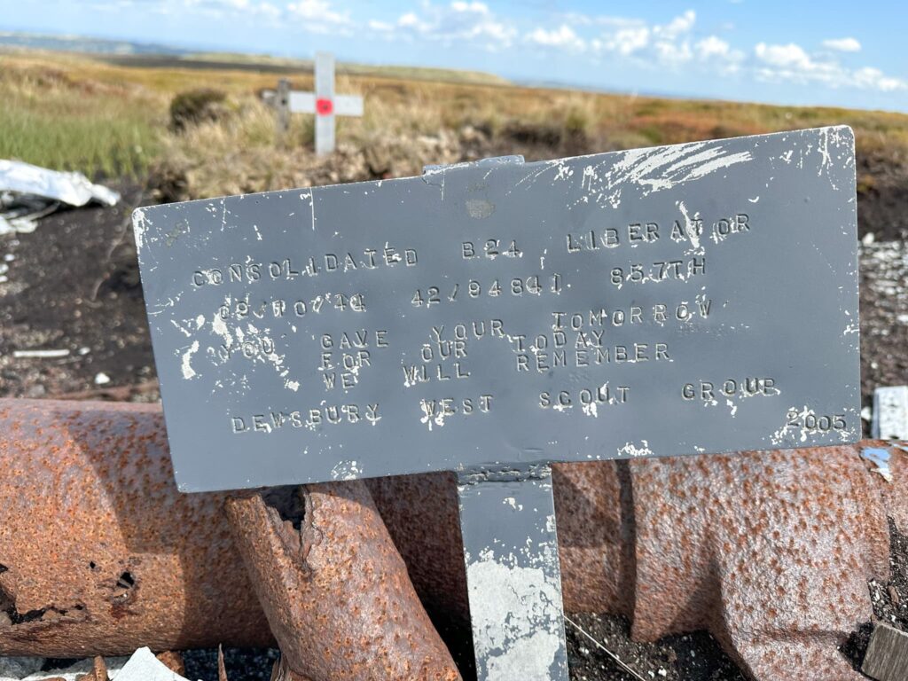
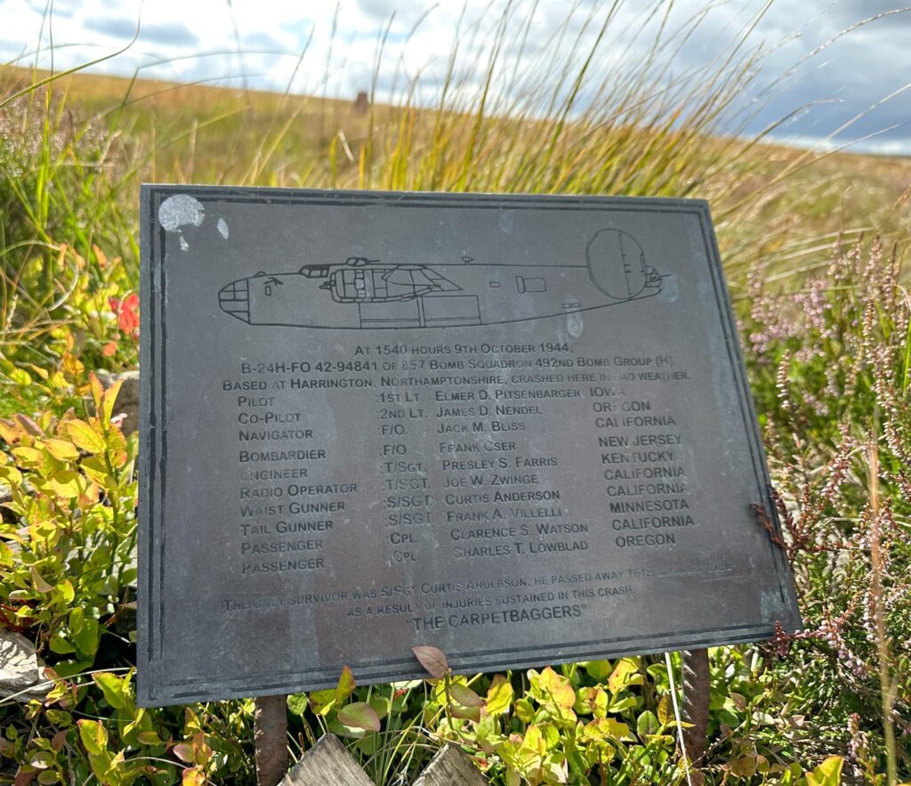
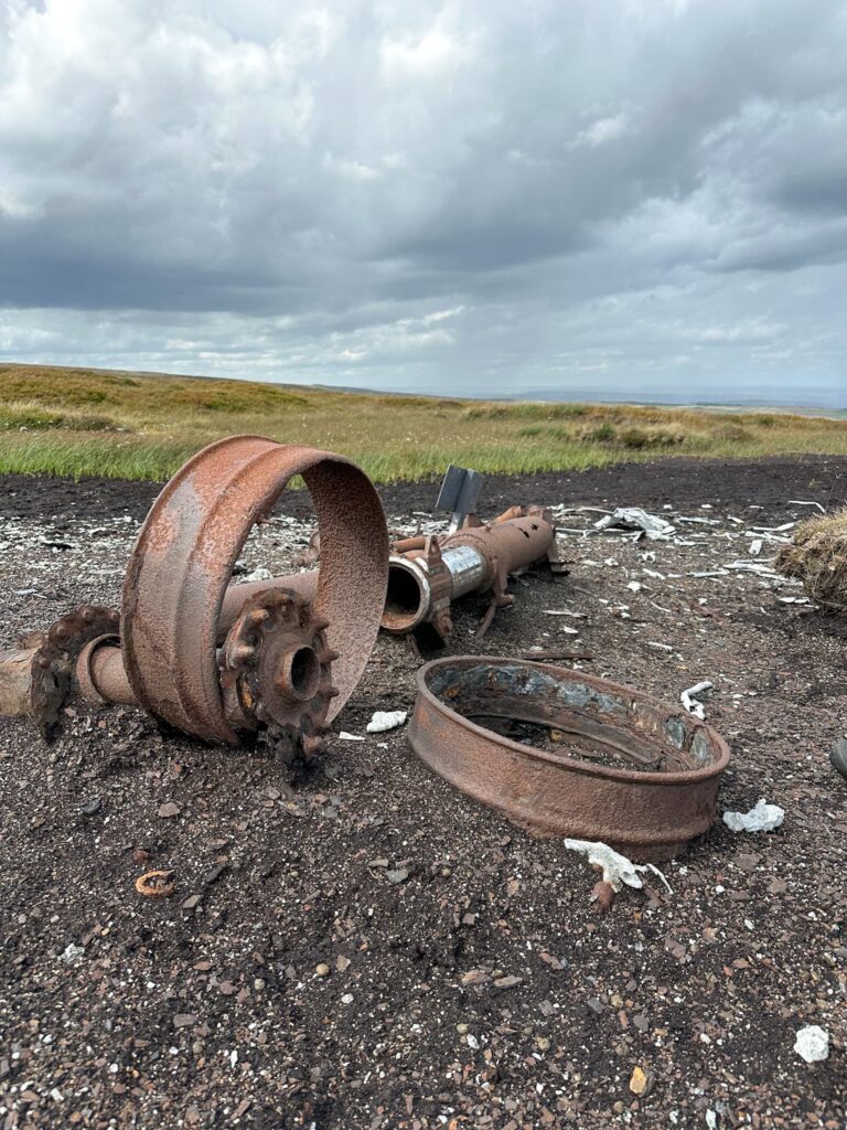
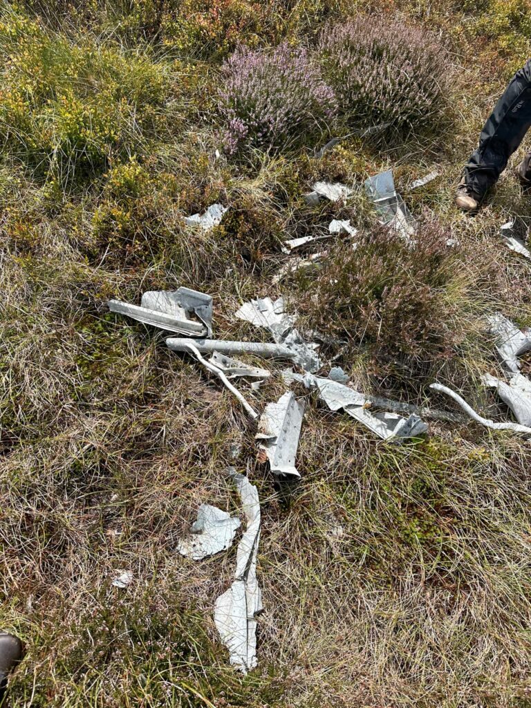
The B24-H Liberator Sack Time was flying on a training exercise to test out repairs when it crashed into the moorland on 9 October 1944, with only one survivor. It is thought that the plane was flying too low to avoid low cloud and hit the moorland, gouging a trail 200m long on the moors before bursting into flames.
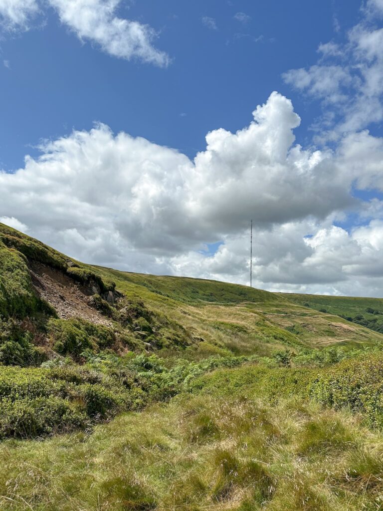
We started our walk from the Holme Moss car park and headed north-east down Wilmer Hill (which is great for sledging down, by the way!). The path winds around the hillside, with some rather wet areas meaning there’s a bit of bog jumping involved.

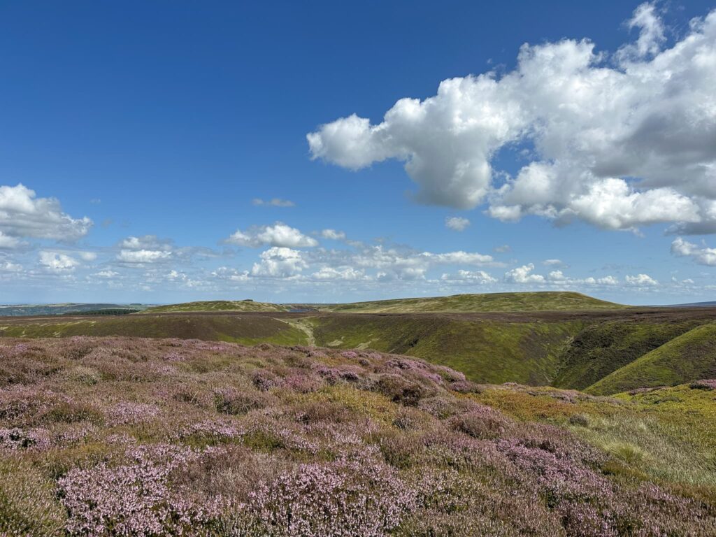
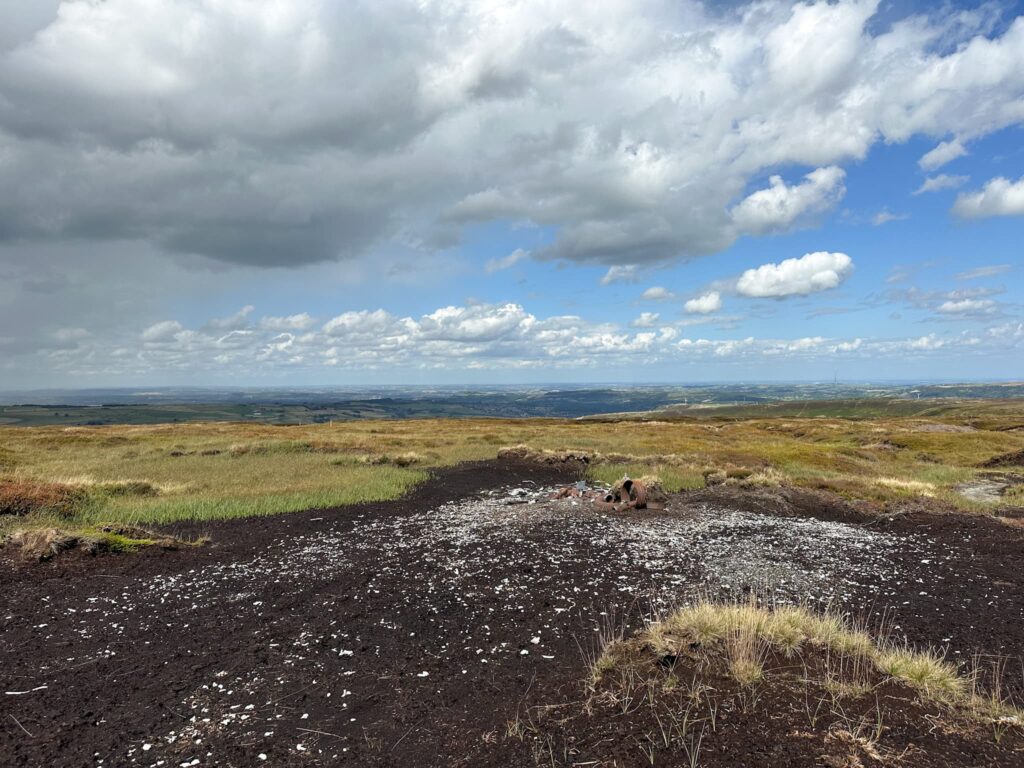
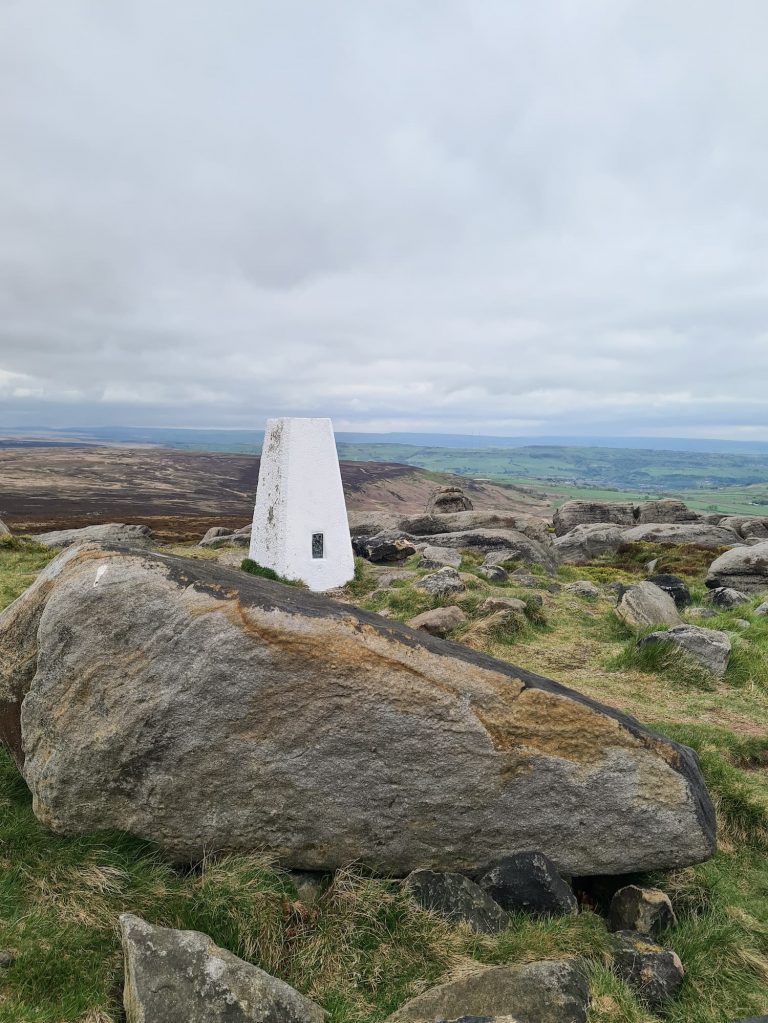
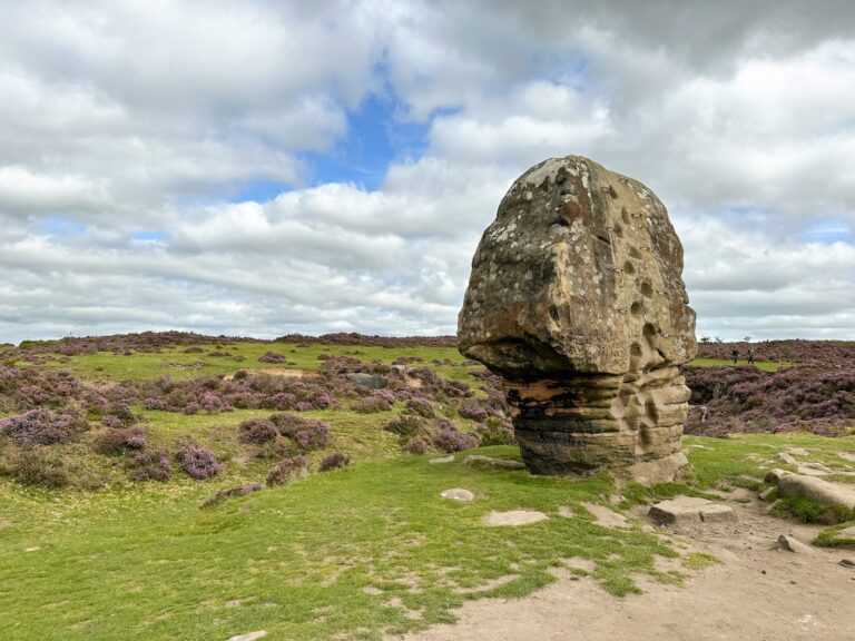
After 1.65 miles, the path turns up the gamekeepers track to climb up to Herbage Edge. From here there are views across Ramsden Clough to Snailsden and Cooks Study Hill. The path follows the edge of Ramsden Rocks over Herbage Hill, parts of which can be very wet and boggy, and then heads west over Twizle Head Moss.
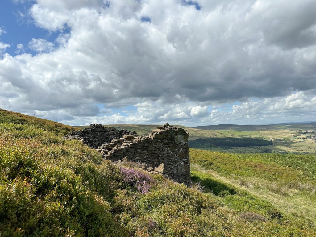
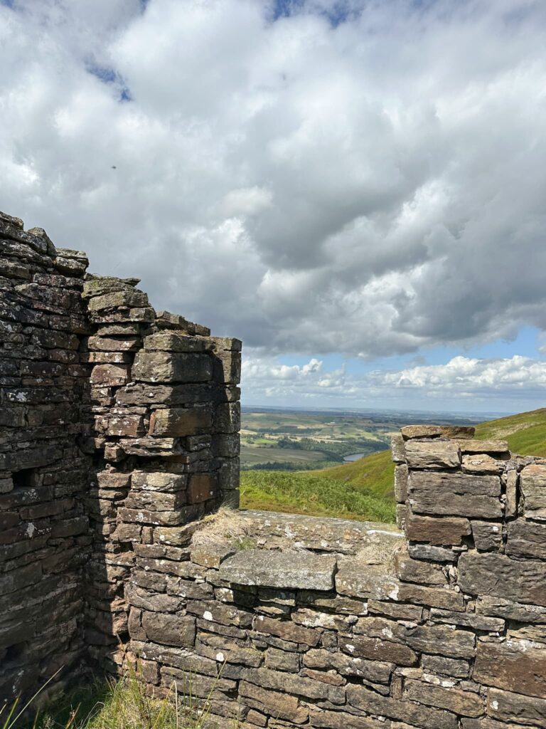
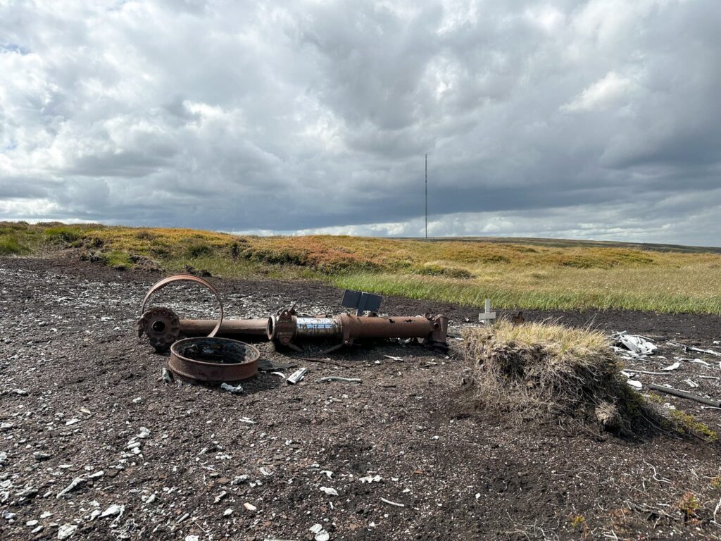
After a little detour to the remains of Red Cabin, we followed the path around for 0.75 of a mile and then turned south-west to follow a peat grough to the crash site of the B24 Liberator. There are white stakes in the ground (presumably something to do with grouse management) but we followed a line of these to the crash site where there are some memorials to the crew members lost in the crash.
We retraced our steps back to the path, then followed it as it wound it’s way around the hillside back to the car park.
Parts of this walk were very boggy and care should be taken avoiding falling in the peat bogs. This is not a white trainers bimble! As this is a grouse moor, there are signs up saying dogs aren’t allowed on the moorland to protect ground nesting birds.
Walk Details:

Walk Route (Opens in OS Maps): Twizle Head Moss Skyline Walk
Parking: Holme Moss Car Park, Woodhead Road, HD9 2QH
Dogs: Not allowed on this moor. There are signs on the gates advising of this, and you can check out the Natural England Open Access Map for more detail. This route follows paths on the ground, but these are not designated as Public Rights of Way.
Facilities: None. Please take all your rubbish home.
Walk Time: 2-3 hours
Difficulty: ▲▲
Distance: 4 miles (6.02km)
Elevation: 906ft (276m)
Trig Points Bagged: None
Peak District Peaks Bagged: None
Peak District Ethels Bagged: None
For more Peak District plane crash walks, you might like:
- Peak District Plane Crashes
- Tintwistle Seven Falls and Plane Crash Sites
- Bleaklow Plane Crash Walk
- B29 “Overexposed” Crash Site on Bleaklow – A Guide
- Shining Clough Scramble to Bleaklow
- Higher Shelf Stones via Ashton Clough Scramble
- Edale to the Dragon Rapide on Kinder Scout
- Brown Knoll Plane Wrecks Walk | 7.5 Miles


My great GRANDAD Fred saw this plan crash. He watched it from his Garden in Holme, he told me about it when I was around 7-‘ 8 years old.
Way he described it was a large American bomber crashed on the edge of the moss. It must have been clear visibility.
Wow, that must have been quite a sight! The plane was flying low to avoid low cloud and didn’t account for the fact that the moss rises up – they couldn’t clear it in time unfortunately – apparently another 20m would have seen them clear. There’s more on the crash on https://aircrashsites.co.uk/air-crash-sites-5/usaaf-b-24h-42-94841-sack-time-on-twizle-head-moss-yorkshire-england/ which is a really interesting read.
I tried to follow the directions above but the instructions were very limited to the point I ended up retracing my steps back to the car park. Never found the crash site which was disappointing as that’s why I wanted to do the route.
There’s a Komoot route in the above description but I don’t seem to be able to find it on the actual Komoot app. All in all limited directions but It would have been easier if I Had been able to find the ROUTE on Komoot.
Hi Jason, thanks for your comment. There is a link (green button above the Komoot map) to download the gpx file so you can use this in any map app on your phone which will guide you to the crash site – it’s not somewhere you can direct someone to in a blog post unfortunately. By clicking on the Komoot map link you should be taken to Komoot and the route is definitely on there and set to public. Would you like me to send you the gpx file so you can load it in OS Maps or another map app?