Dark Peak Snake | 20 Miles
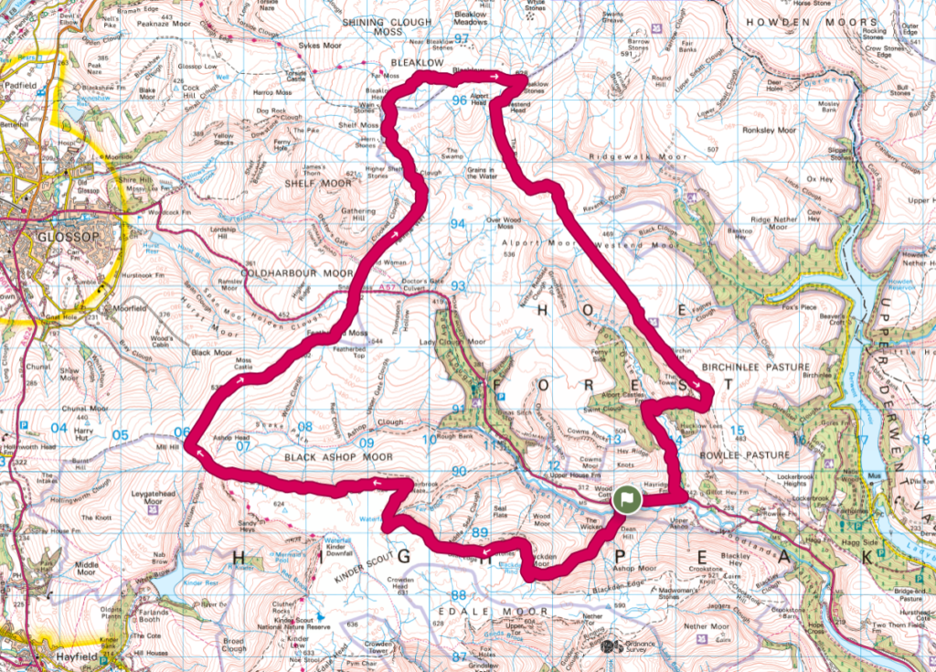
If you’re looking for a proper Peak District challenge walk, the Dark Peak Snake is one to add to your list. This 20 mile route links together some of the wildest and most remote landscapes in the Peak District, starting with a hands-on scramble up Blackden Brook onto Kinder Scout before following the dramatic northern edge across to Mill Hill.
From there, the route joins the Pennine Way to cross Bleaklow, before heading out over the vast moorland of Alport Moor and Westend Moor via Alport Castles. Expect big views, rugged terrain and long stretches of exposed, featureless moorland. This is a serious day out best suited to experienced walkers who are confident navigating in remote conditions. Most walkers take 8 to 10 hours to complete the route.
This route is one devised by the Long Distance Walkers Association but I have tweaked the route slightly around Bleaklow (to make it easier to navigate). You can get the original route from their website. If you enjoy long walks, please consider joining the LDWA – it’s well worth the money! They host regular challenge events and have a huge database of long distance walks.
Route Highlights
- Scrambling up Grade 1 Blackden Brook onto Kinder Scout, passing numerous waterfalls
- Following the dramatic northern edge of Kinder Scout with wide, open views
- Crossing the remote moorland to Mill Hill
- Walking a section of the Pennine Way across Bleaklow
- Exploring the wild and rugged landscape of Bleaklow
- Crossing the vast, quiet expanse of Alport Moor
- Reaching the Westend Moor trig point
- Visiting the impressive landslip at Alport Castles
- Experiencing true Dark Peak wilderness with long, remote moorland sections
Dark Peak Snake Walk Overview
- Distance – 20 miles
- Difficulty – Challenging
- Route type – Circular
- Start point – Layby near the entrance to Blackden Brook on the Snake Pass
- Terrain – Moorland, peat bog, rocky scramble, rough paths
- Facilities – None on route
Dark Peak Snake Walk
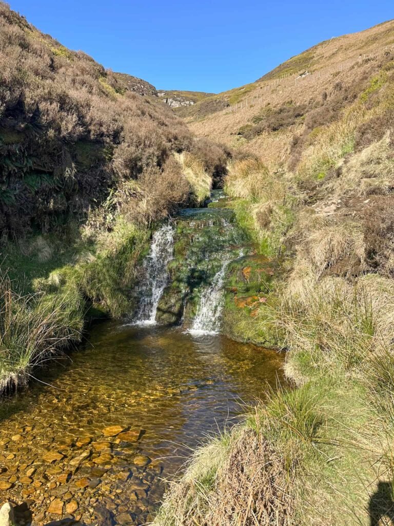
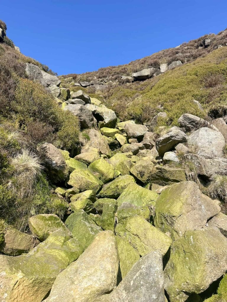
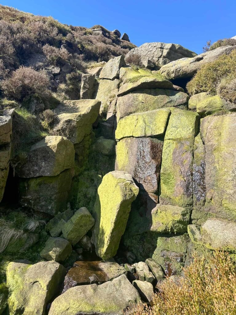
The walk starts from a layby near the entrance to Blackden Brook and heads down the hill to cross the River Ashop. From here the path winds it’s way up Blackden Brook, passing waterfalls and getting rockier as you climb further uphill until it becomes a Grade 1 scramble up to the top.
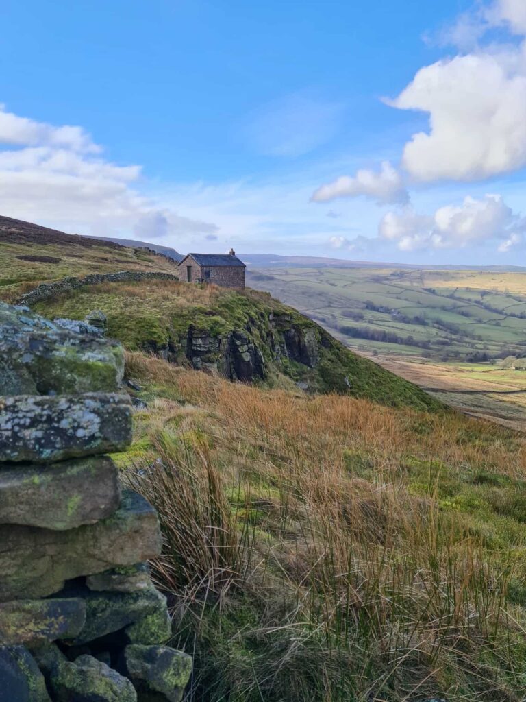
At the top I turned right and made my way along Seal Edge, one of the northern edges of Kinder Scout. The route passes Fairbrook Naze and continues on, passing Upper Red Brook and Nether Red Brook (both great scrambles). It then heads downhill to join the Pennine Way steps at Ashop Head.
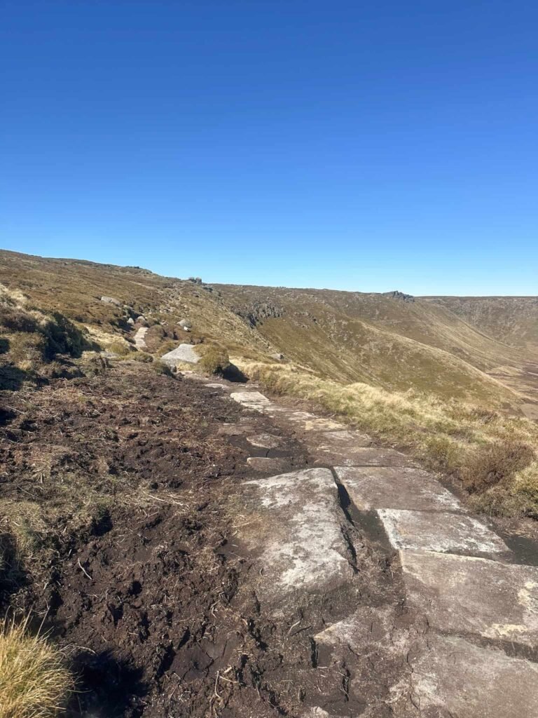
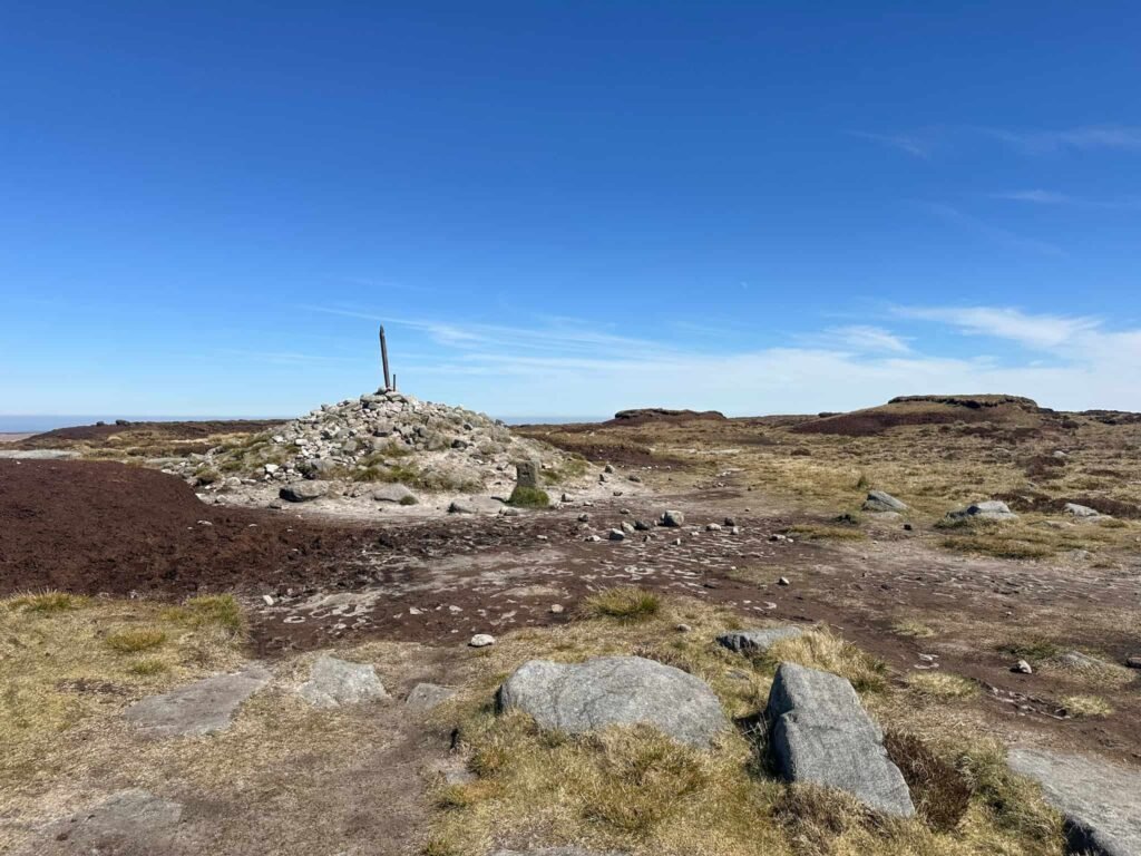
The route follows the Pennine Way, passing the Snake Inn crossroads sign, and reaches Mill Hill, marked with a cairn and a stone Pennine Way marker. Turning right to head north-east, I followed the stone slabs past Moss Castle and Featherbed Moss to reach the Snake Pass summit.
Crossing the road, I followed the Pennine Way to Bleaklow Head.
The original LDWA route followed the line of stakes from Bleaklow Head to Bleaklow Hill but I found this really tough going over peat hags and groughs and hard to navigate as a lot of the stakes are missing now. My alternative follows more-established (albeit faint) paths on the ground to make the going a little easier.
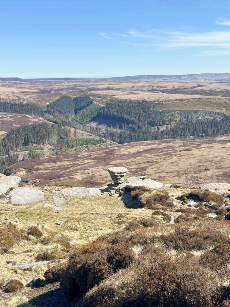
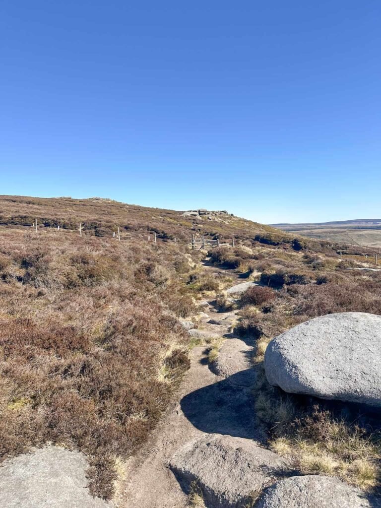
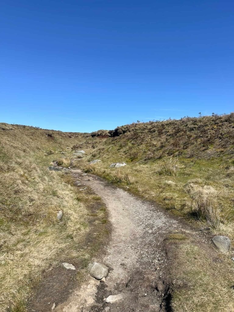
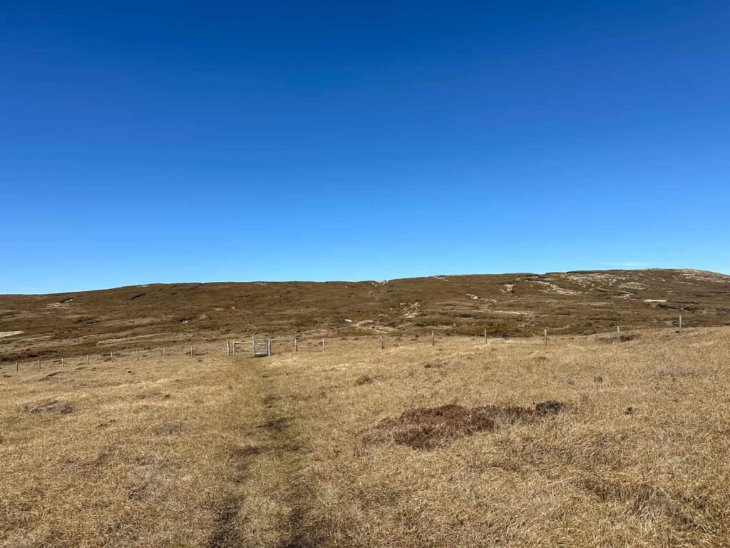
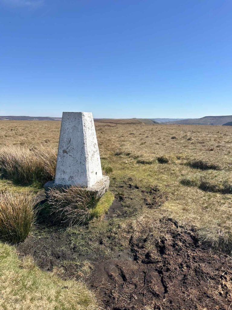
Reaching Bleaklow Stones, the route heads south-west to pick up a faint path running downhill to a gate in long fence. Through the gate, I followed an intermittent, boggy path running over The Ridge to the Westend Moor trig point. This is very wet in places and there’s some bog jumping to do! The path skirts the Ethel of Alport Moor, but you can take a short detour if you’re ticking off Ethels.
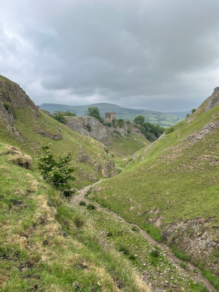
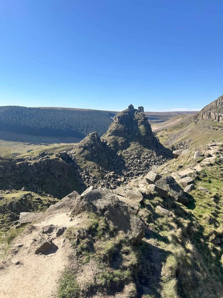
From the trig point, the path starts out faint but eventually becomes more substantial towards Birchen Hat, and the follows the path over the top of Alport Castles. This is apparently the largest landslip in the UK and is rather spectacular.
I left the route here and followed the path down the hillside to the Tower viewing area, then picked my way over the boulders to rejoin the path which then starts to drop steeply downhill to meet the River Alport. Crossing the bridge, the route heads up through Alport Castles Farm then follows the farm track.
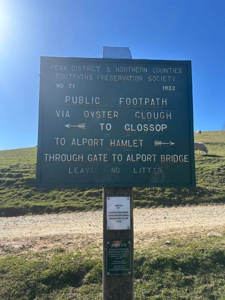
At the Peak and Northern Footpath Sign (green sign) I followed the path downhill through the field, which rejoins the main road. Turning right, I walked back along the road for about 1km (0.6 miles) to the car.
This was a tough walk, one for experienced walkers who are confident navigating and don’t mind wet feet. I picked a sunny Spring day, and it’s worth nothing there isn’t much shade so pack some sun cream (I wish I had!).
Tips for This Walk
- Navigation skills are essential as large sections are pathless.
- The terrain is often wet and boggy, even in dry weather.
- Weather conditions can change quickly on the moors.
- Carry a map, compass and GPX route.
- Allow plenty of time and start early.
- Take plenty of snacks and water.
Parking for the Walk
There is roadside parking available near Snake Pass, but spaces are limited. Arriving early is recommended, especially at weekends.
Who This Walk Is For
This walk is ideal for:
- experienced walkers looking for a Peak District challenge walk
- hikers training for long-distance routes
- walkers wanting to explore remote Dark Peak moorland
- those interested in trig points and wild landscapes
FAQs
How long does the Dark Peak Snake walk take?
Most walkers complete the 20 mile route in around 8 to 10 hours.
Is the Dark Peak Snake suitable for beginners?
No, this is a challenging route with difficult terrain and navigation.
Do you need navigation skills for this walk?
Yes, sections of the route cross featureless moorland with no clear paths.
What is the hardest part of the walk?
The combination of distance, boggy terrain and navigation across Bleaklow and Alport Moor.
Walk Route in OS Maps: Dark Peak Snake Walk
Parking: Free parking in the Blackden Brook layby on Snake Pass, S33 0AB is the nearest postcode W3W:///gifts.delighted.rollover
Facilities: None – remember to leave no trace and take all your rubbish away with you.
Dogs: Dogs should be on a short lead between 1 March and 31 July to protect ground nesting birds – it’s the law. This route uses Open Access Land as well as designated public footpaths.
Walk Time: 8-10 hours
Difficulty: ▲▲▲
Distance: 20 miles (32km)
Elevation: 2815ft (858m)
Trig Points Bagged: Westend Moor
Peak District Peaks Bagged: Bleaklow Head, Mill Hill
Peak District Ethels Bagged: Mill Hill, Bleaklow Head – you could also add in Alport Moor with a short detour
For more Peak District challenge walks you might like: