Peak District Plane Crashes & Walks to Find Them


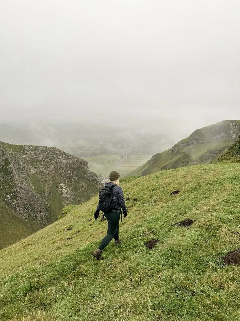
There are hundreds of Peak District plane wreck sites dotted all over the National Park. Most of the plane crashes happened during wartime, with bad weather being a major factor in a lot of them. This is a collection of walks to Peak District plane crashes, most of which are on remote moorland.
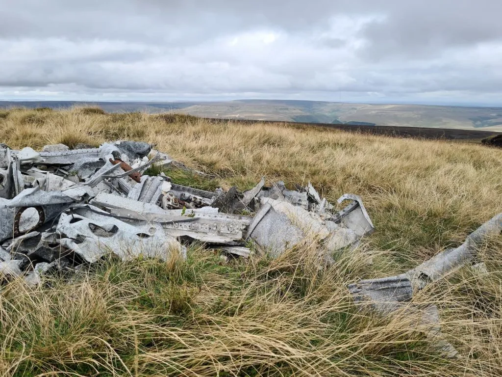
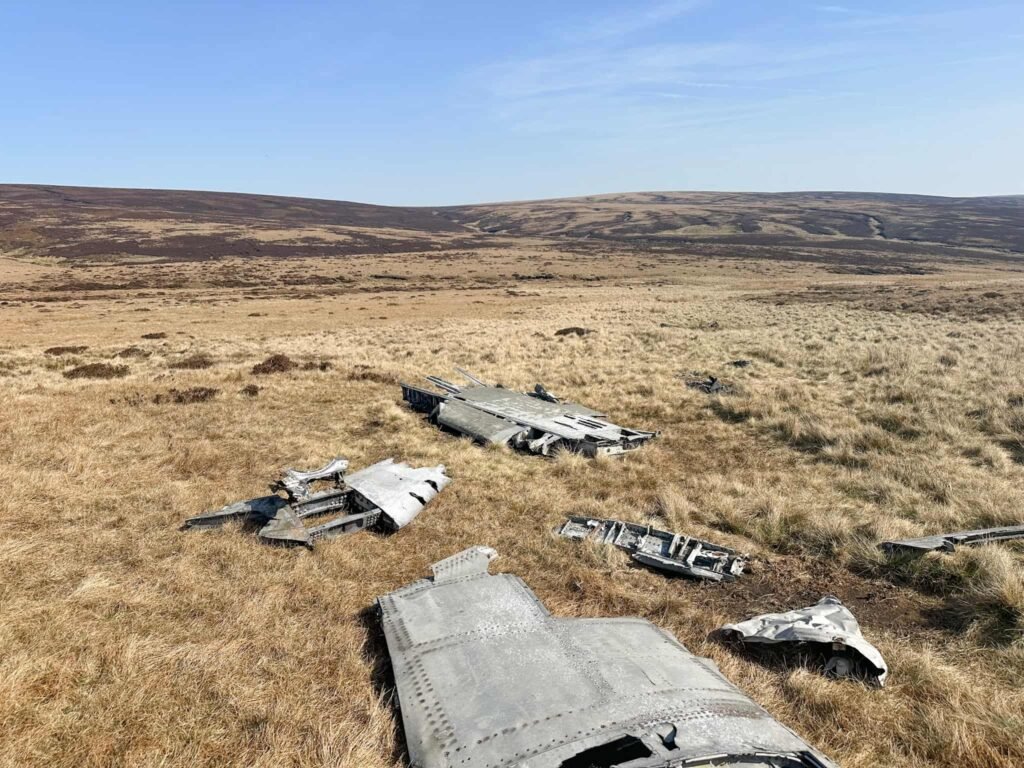
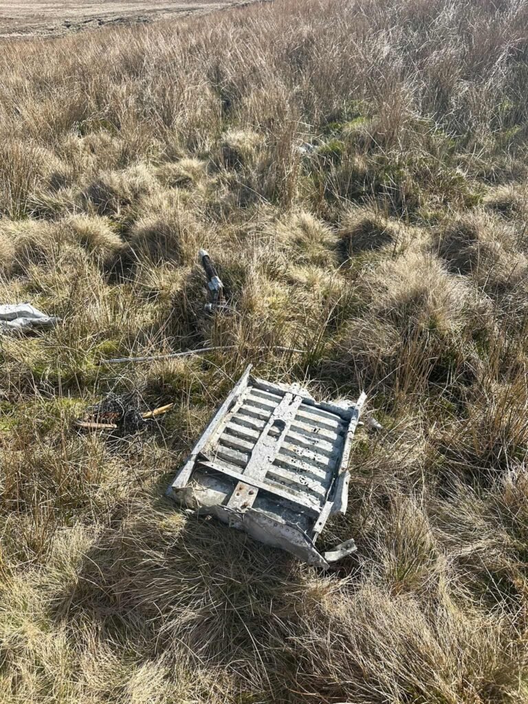
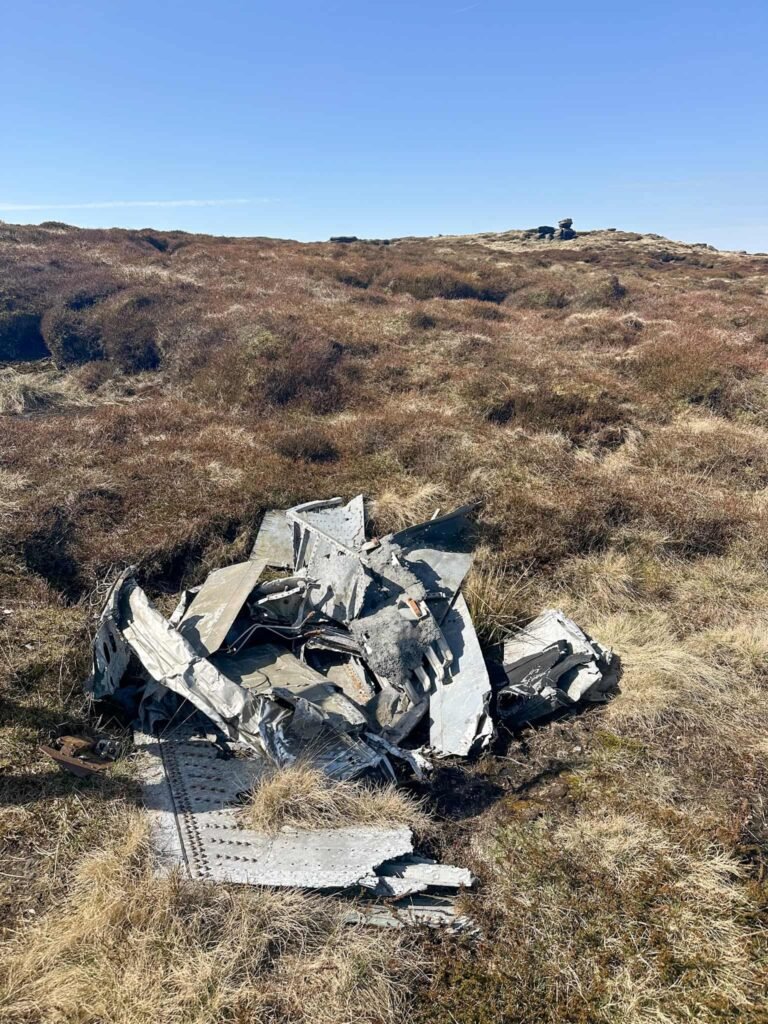
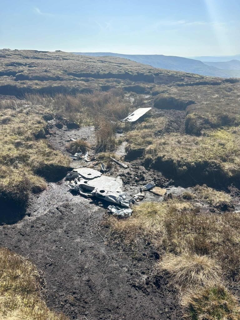
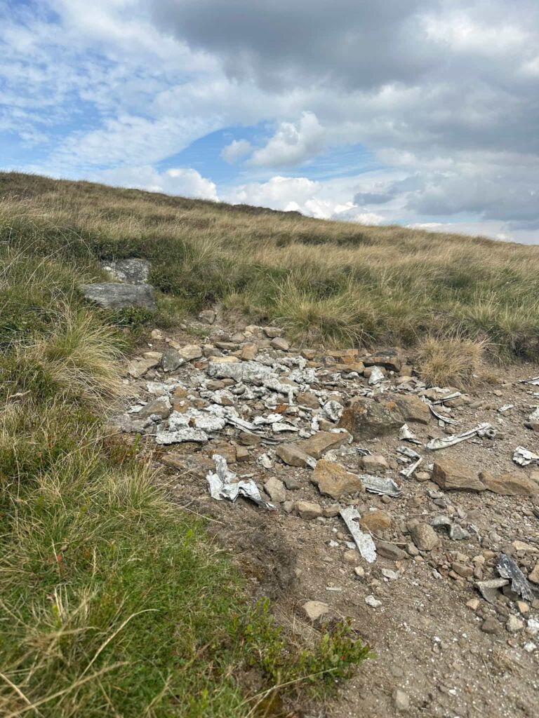
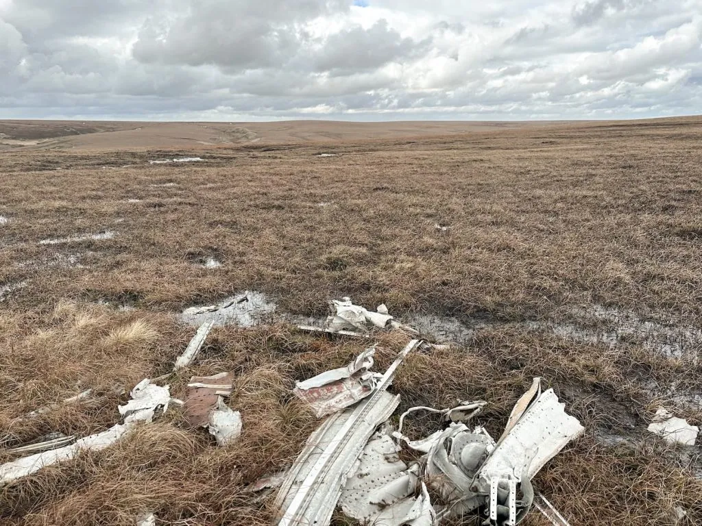
The amount of wreckage at these Peak District plane crash sites varies greatly, with some such as the Over Exposed site at Higher Shelf Stones having a lot remaining.
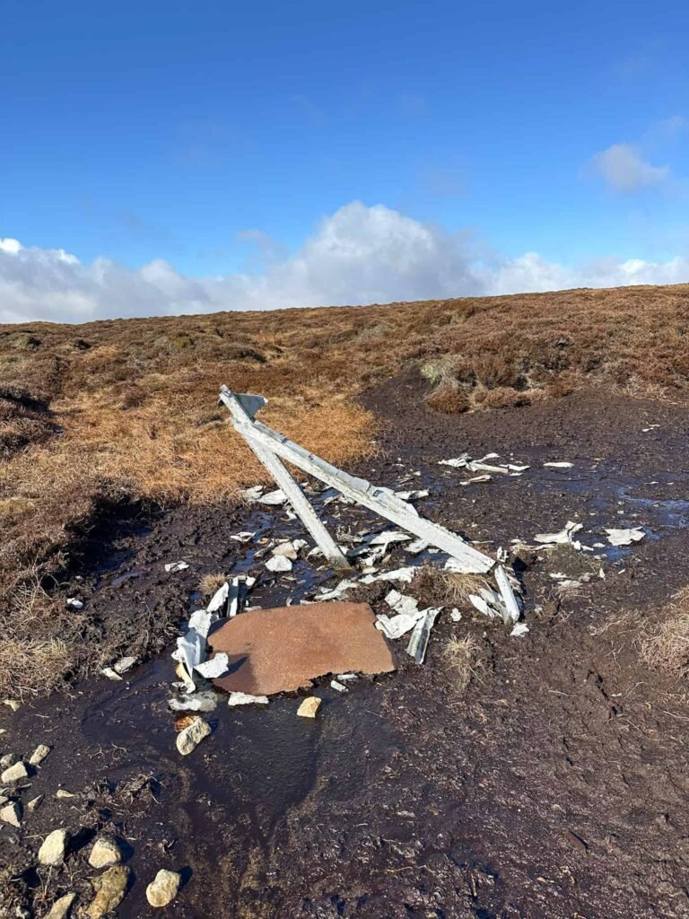
These plane crash sites are all on remote moorland, and walks to these sites should only be undertaken if you’re able to navigate and are fully prepared for what can be treacherous weather conditions, which are the reason many of these crashes happened. They can be very difficult to find in misty murky weather. Some of the debris pools are very small, and they can be hidden in peat groughs or long grasses.
For more in depth details on the crew on each plane crash, you can visit Aircrashsites.co.uk.
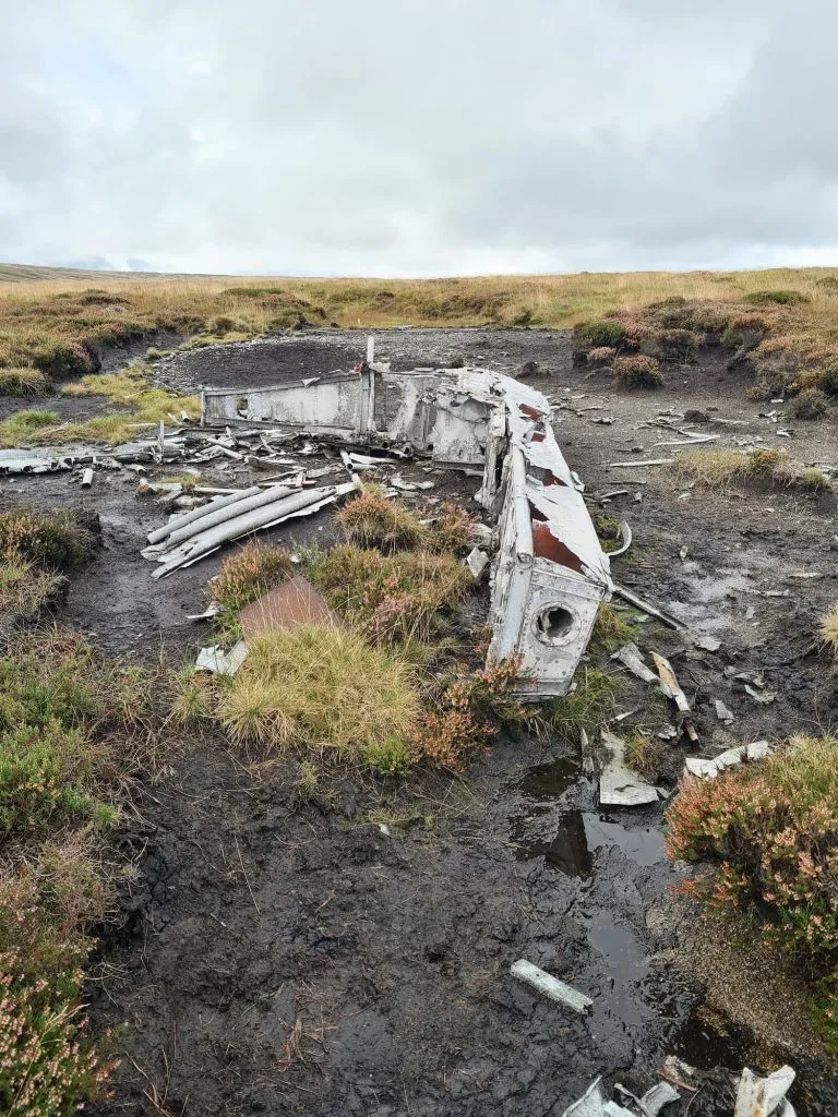
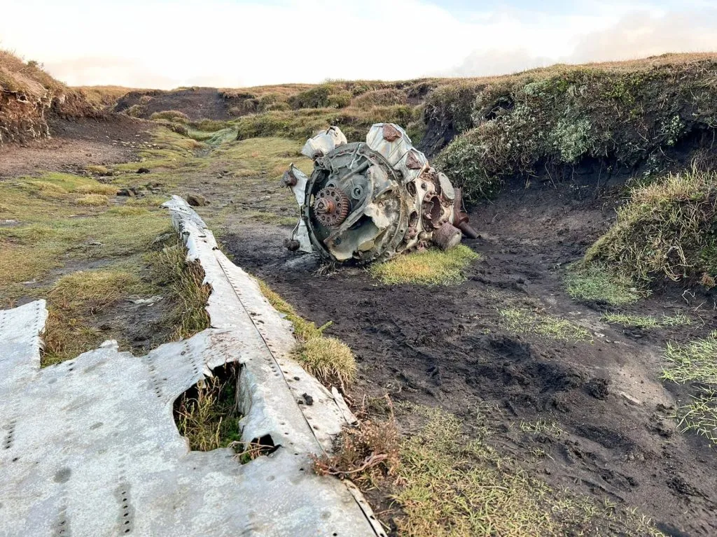
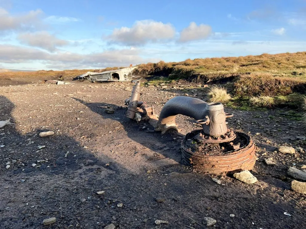
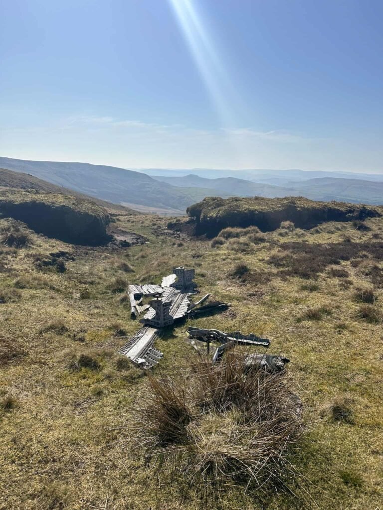
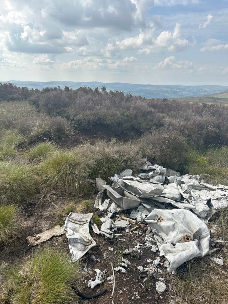
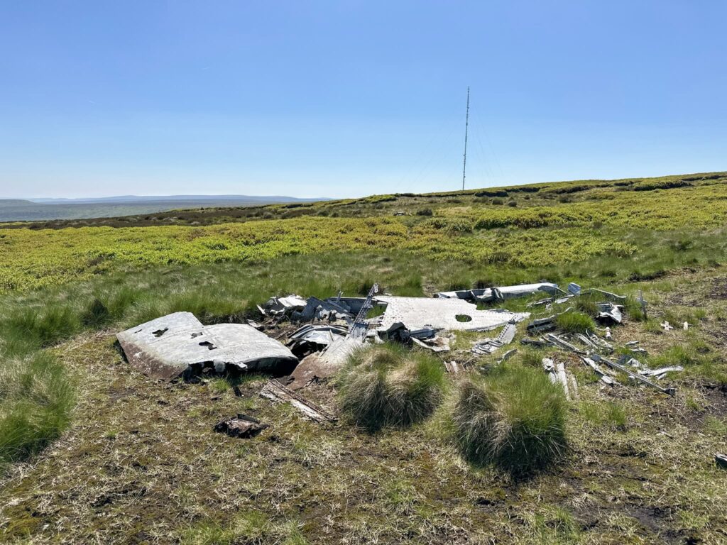
RB29a Superfortress “Over Exposed” – Higher Shelf Stones, Bleaklow
Route Details: B29 “Overexposed” Crash Site on Bleaklow: A Guide
RB-29A Superfortress crash site grid reference: SK09042 94912
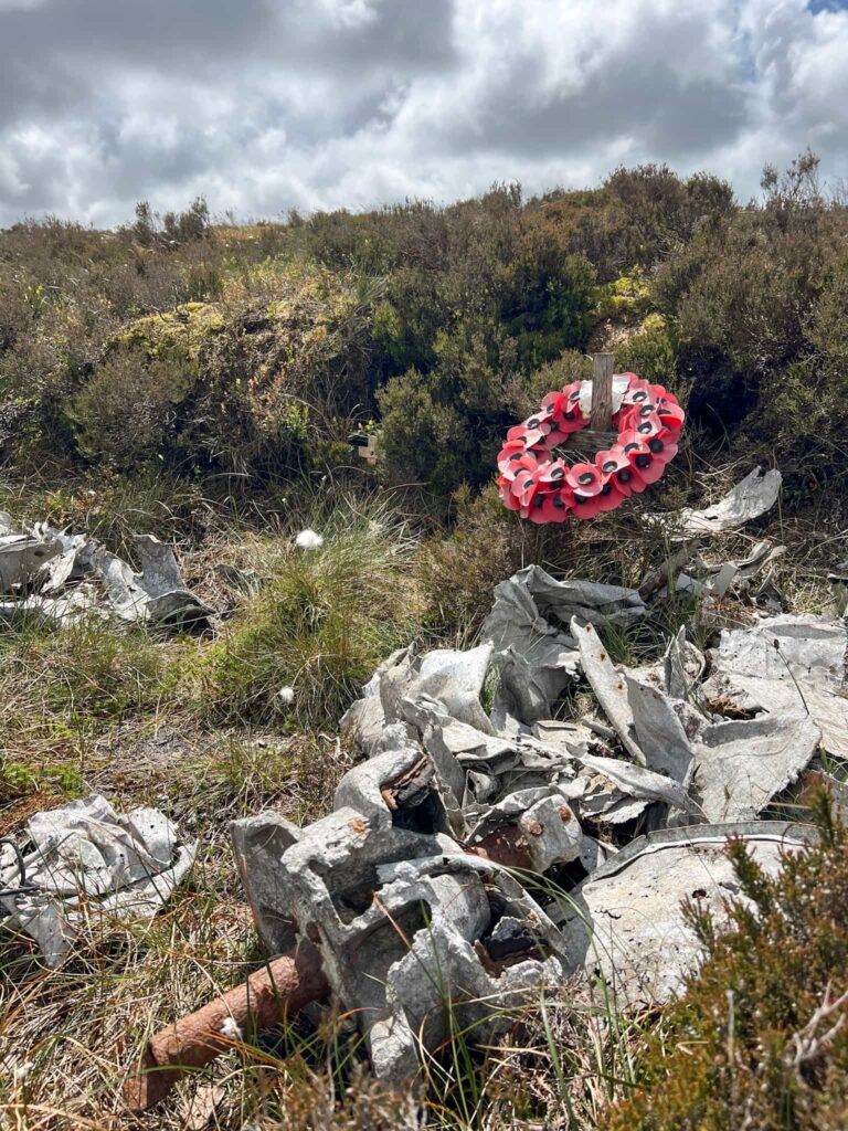
This is the most popular and well visited plane crash site in the Peak District, being the site where the modified Superfortress crashed into the cloud covered moorland on 3 November 1948, killing everyone on board. There is a considerable amount of debris, although this is getting less and less as people take pieces away with them. It’s very easy to get lost on the way to this crash site and during lockdown it’s popularity increased immeasurably. It’s known as “the Bleaklow bomber” or “the plane crash site on Bleaklow” but there are many others!
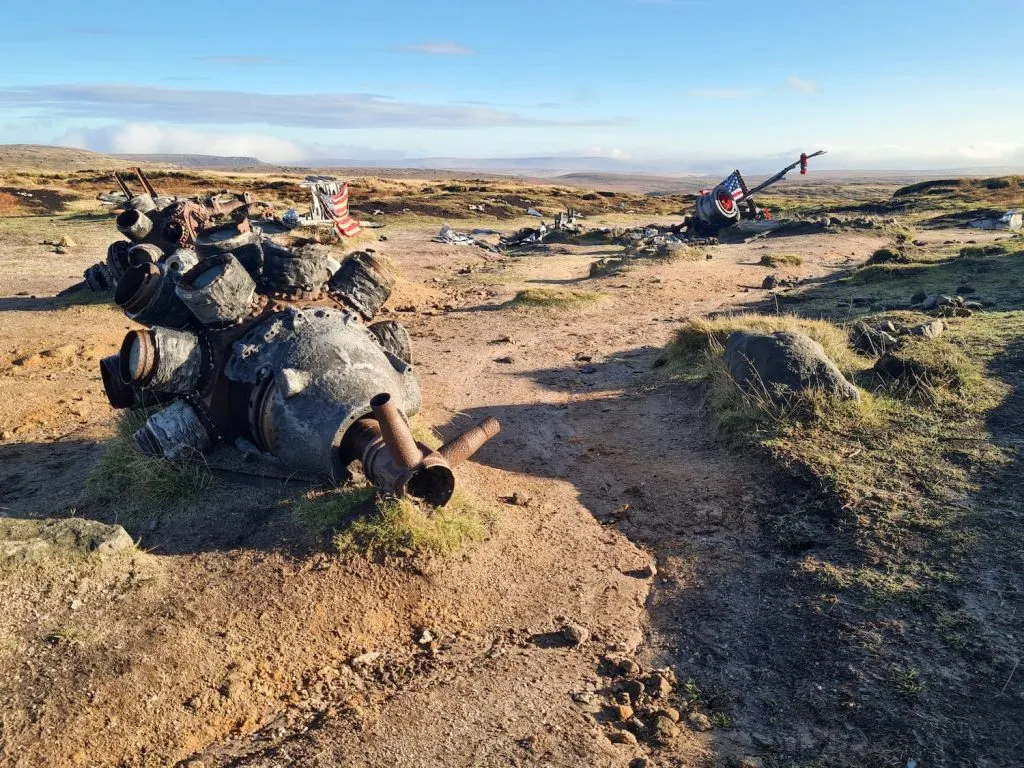
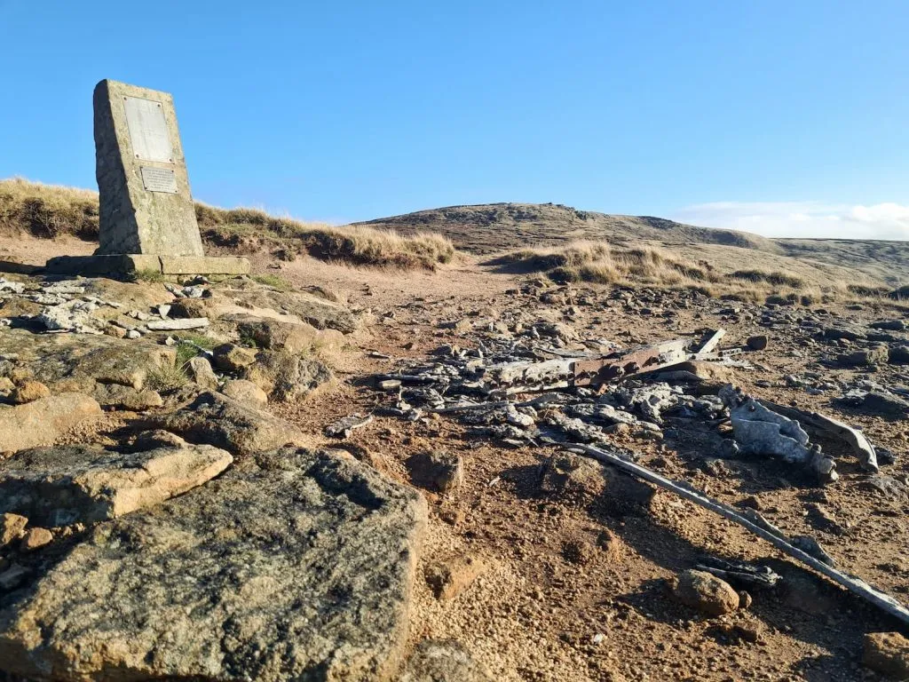
Again there is a memorial pillar to those who lost their lives in the crash.
We visited this on two different walks and there’s a guide below:
- Bleaklow Plane Crash Walk
- Bleaklow to Higher Shelf Stones Circular Hike
- How to Find The B29 “Overexposed” Plane Crash Site on Bleaklow – A Guide
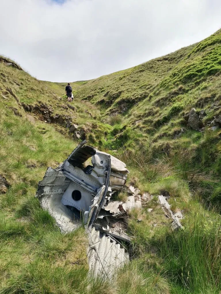
Bristol Blenheim Mk 1 L1476 – Sykes Moor, Bleaklow
Route Details: Wildboar Clough Scramble
Bristol Blenheim crash site grid reference: SK 08295 97035
This is a challenging scramble walk up the Grade 2 Wildboar Clough onto Sykes Moor near Bleaklow to discover the site of the Bristol Blenheim Mk 1 L1476 which crashed on 30 January 1939 killing both occupants.

The site is marked by debris and a memorial pillar to those who lost their lives in the crash.
Vickers Armstrong Wellington R1011 – Birchen Bank Moss, Bleaklow
Route Details: Shining Clough Scramble to Bleaklow
Wellington R1011 crash site grid reference: SK 10544 98580
The Wellington was part of a group of similar planes on a training mission in 1943 when it crashed into Birchen Bank Moss in poor visibility, killing 3 crewmen. Just 30 minutes after this crash another of the planes in the group crashed near Stoke. There is a memorial at the crash site to those who lost their lives.
Blackburn Botha Mk1 W5103, Round Hill, Bleaklow
Route Details: Middle Black Clough Waterfall and Bleaklow Stones
Blackburn Botha Mk1 W5103 crash site grid reference: SK 11073 97536
The Blackburn Botha Mk 1 w5103 crashed into the moorland on 10 December 1941. It is thought the pilot was attempting to fly above the cloud which covered the hills. He appears to have descended, thinking that he had cleared the hills but a head wind may have slowed his progress. The aircraft struck the moorland and was destroyed.
Boulton-Paul Defiant N3378, Near Bleaklow Stones, Bleaklow
Route Details: Middle Black Clough Waterfall and Bleaklow Stones
Defiant N3378 crash site grid reference: SK 10649 96948
This plane crashed on 29 August 1941 in cloud cover. Both occupants survived the initial crash only to perish from exposure on the remote moorland.
Avro Lancaster BMk 10 KB993, James Thorn, Shelf Moor
Route Details: Bleaklow Plane Crash Walk
Lancaster crash site grid reference: SK 07928 94781
The Lancaster crashed on 18 May 1945, just 10 days after the war in Europe had ended and days before the squadron were due to return to Canada.
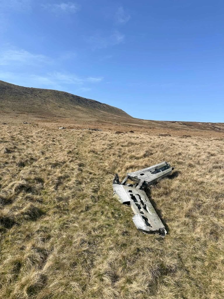
Douglas C47 Skytrain Dakota, Ashton Clough, Shelf Moor
Route Details: Higher Shelf Stones via Ashton Clough Scramble
C47 Dakota crash site grid reference: SK 08052 94734 is a good bet for part of the debris. The debris is spread all the way up Ashton Clough as it was pushed down the hillside by the recovery crew.
The American C47 Skytrain 2108982 transport plane Dakota crashed on 24 July 1945, tragically killing everyone on board. The pilot was flying at too low an altitude and flew into the moorland.
B24J Liberator, Mill Hill, near Kinder Scout
Route Details: Bleaklow Plane Crash Walk
B24J Liberator crash site grid reference: SK 05844 90610
The Liberator crashed on 11 October 1944, with both crew members miraculously surviving the crash and being able to walk to Glossop for assistance. There are two main debris pools now, with one of them being right next to the path leading from Mill Hill to Harry Hut and the other being just off the path to the north-west.
Handley Page Halifax, Kinder Scout
Route Details: Kinder Scout Plane Crash Walk – Ringing Roger Circular from Edale | 6.5 Miles
Handley Page Halifax grid reference: SK13082 87632 (main debris pool) and SK13039 87745 (smaller debris pool).
The Handley Page Halifax crashed in 1943 following a bombing raid in Frankfurt. The plane crashed into the moorland, killing 5 out of the 7 crew.
FMK4 Sabres XD707 and XD730, Kinder Scout
Route Details: Sabres on Kinder Scout and Upper Red Brook Scramble
There are numerous debris pools for the Sabres on Kinder Scout at grid references:
- SK 06926 89664
- SK 07268 90236
- SK 07300 90100
- SK 07548 90390
These two planes were flying together and crashed into the Kinder Scout plateau, bounced for around 900m and then crashed onto Black Ashop Moor, leaving a trail of debris behind them. Both pilots were sadly killed.
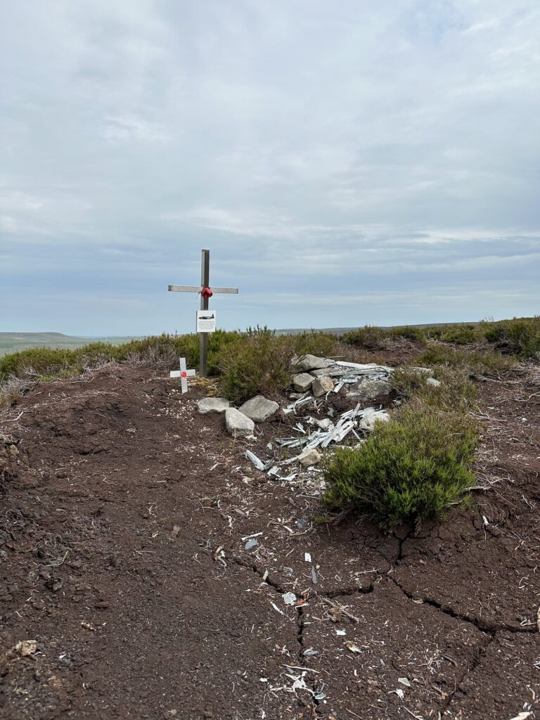
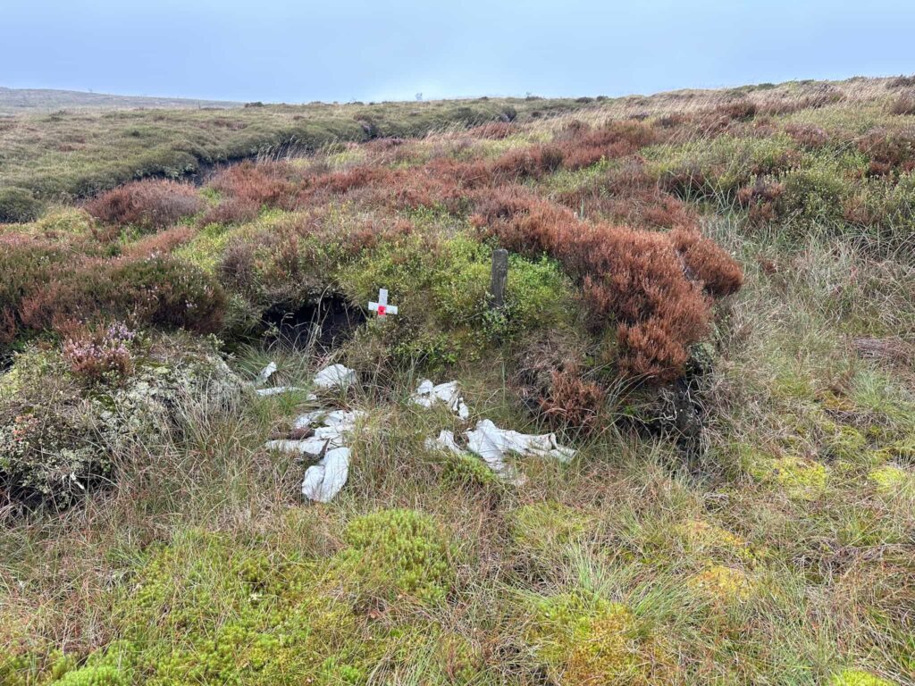
Avro Anson NL185, The Clough/The Woolpacks, Kinder Scout
Route Details: Kinder Scout Plane Crash Sites: Anson NL185 and Harvard FT415 via Crowden Clough | 4.6 Miles
Avro Anson NL185 near The Woolpacks grid reference: SK08903 86696
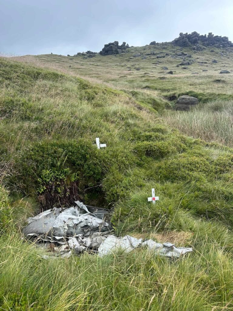
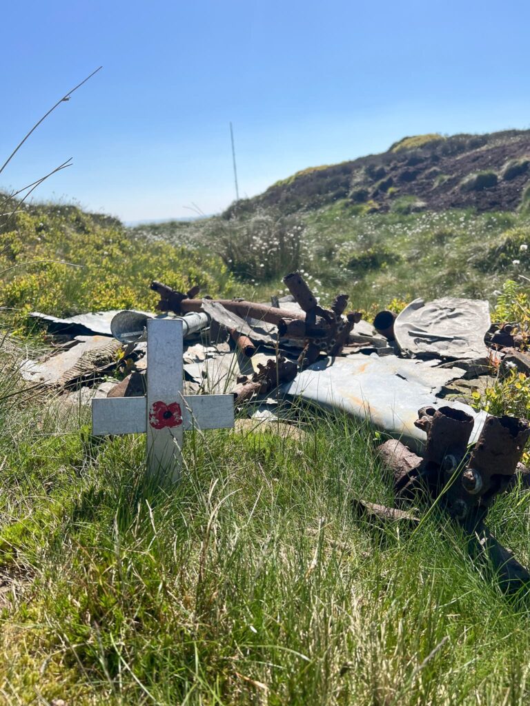
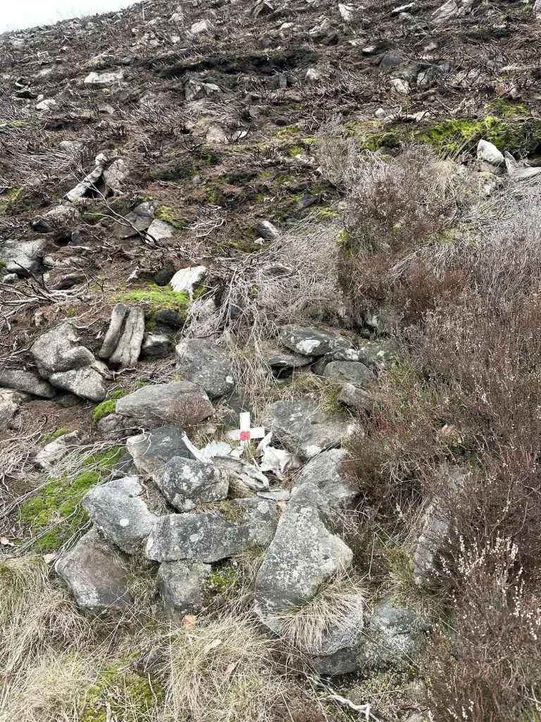
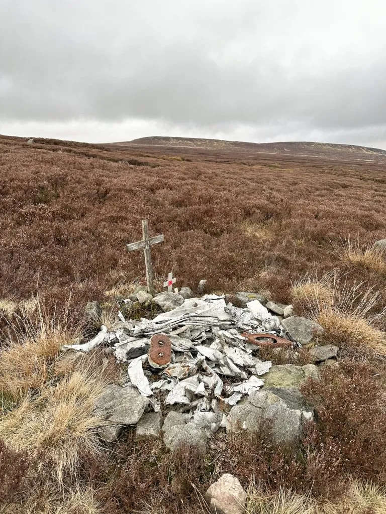
Small panels and other fragments remain at the site near The Clough, below the Woolpacks with items often mistaken for parts of the nearby Harvard. The Anson was being flown by Wing Commander Richard Speare, a highly decorated pilot who had flown agents into occupied Europe during the war. He became lost in poor weather on 23 November 1945 and flew into Kinder Scout at low cloud, and was killed instantly. A small cross at the site marks his memory.
Harvard FT415, The Woolpacks, Kinder Scout
Route Details: Kinder Scout Plane Crash Sites: Anson NL185 and Harvard FT415 via Crowden Clough | 4.6 Miles
Harvard FT415 grid reference: SK08895 86835
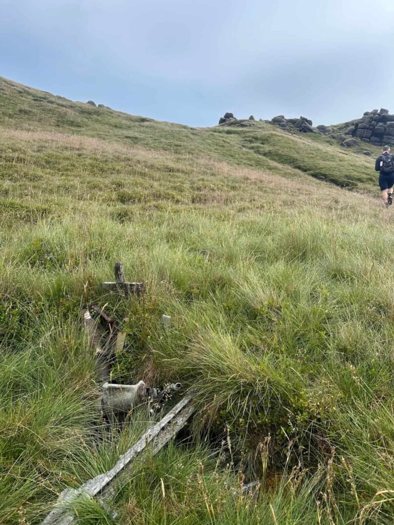
The Harvard came down to the west of the Woolpacks on 14th January 1952 killing pilot Midshipman Brian Farley who was on a cross-country flight from RAF Syerston to RAF Kemble. Remains including an undercarriage leg and other fragments can be found in a waterlogged peat pit.
De Havilland Dragon DH89 Rapide G-ALBC, Kinder Scout
Route Details: Edale to the Dragon Rapide on Kinder Scout
The Dragon Rapide on Edale Moor crash site grid reference: SK 10160 88241
The Rapide crashed in 1963 in poor weather following a photographic expedition. Both crew members were recovered alive by rescue teams, as were their films and cameras!
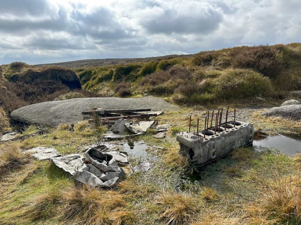
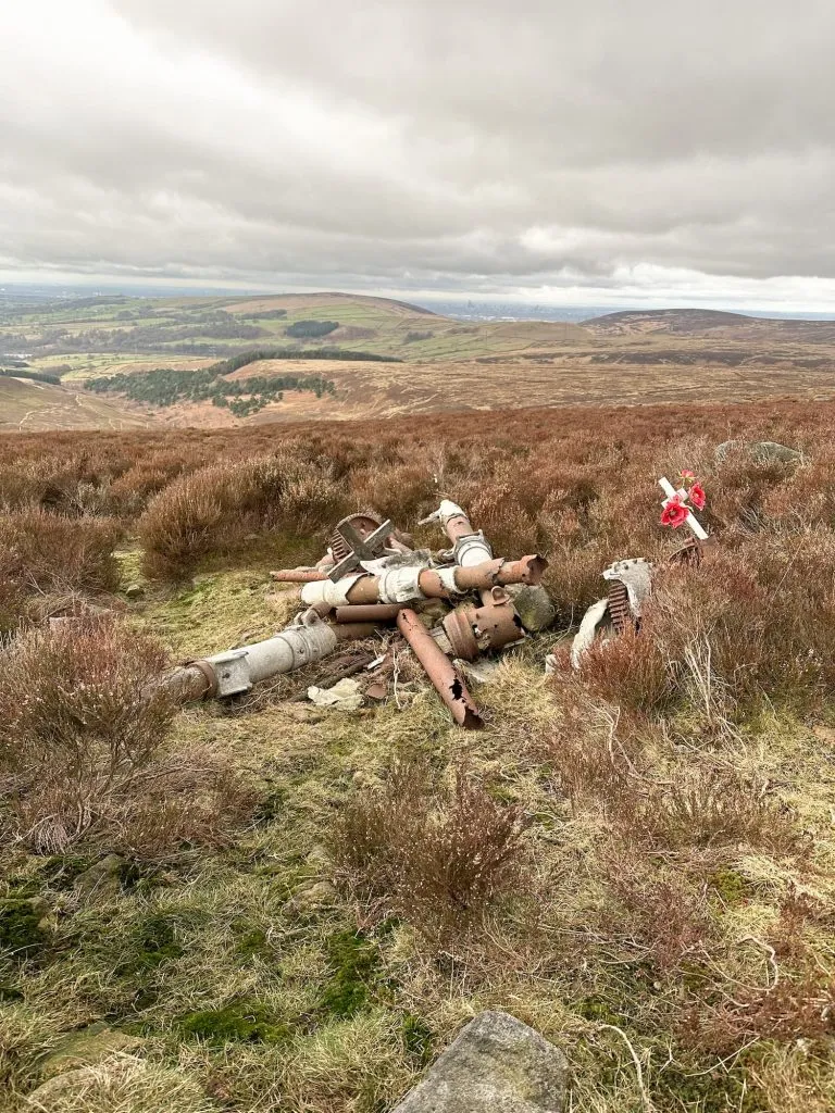
Airspeed Oxford MK 1 HN594, Brown Knoll
Route Details: Brown Knoll Plane Wrecks Walk | 7.5 Miles
Airspeed Oxford MK 1 HN594 Grid Reference: SK 08189 85204
The Airspeed Oxford MK 1 HN594 crashed on 28 December 1945. Everyone thankfully survived, but amazingly it was Flying Officer Edward Croker who, wrapped his fellow aircrew in a parachute then managed to raise the alarm by crawling 2 miles into Upper Booth on what he thought were broken ankles (they turned out to be only badly bruised). Amazing!
Republic P-47C Thunderbolt 41-6227, Horsehill Tor Near Brown Knoll
Route Details: Brown Knoll Plane Wrecks Walk | 7.5 Miles
Republic P-47C Thunderbolt 41-6227 Grid Reference: SK 09344 84337
The Republic P-47C Thunderbolt 41-6227 which crashed on Horsehill Tor on 25 April 1943. The pilot bailed out after losing control and ending up in a spiral dive, but survived with spinal fractures.
Gloster Meteors FMk 8 WA791 and VZ518, Sliddens Moss
Route Details: Black Hill via Crowden Little Brook | 9 Miles
Gloster Meteors on Sliddens Moss Grid Reference: SE 06636 02881
The planes were flying in formation when they crashed on 12 April 1951 after descending too early and ploughing into the hillside, killing both pilots.
Fairey Swordfish Mk1 P4223, Heydon Head, Black Hill
Route Details: Black Hill Plane Wrecks Walk | 4 Miles
Fairey Swordfish crash site grid reference: SE 08338 04762
This plane crashed on 25 January 1940, killing the pilot who was delivering the new plane to Ford, 300 miles to the south. The plane is thought to have crashed due to bad weather – the wreckage was discovered a month after the crash, with the pilot still strapped into his cockpit.
RCAF Sabre MK 2 19234, Great Hill, Holme Moss
Route Details: Black Hill Plane Wrecks Walk | 4 Miles
Sabre MK2 19234 crash site grid reference: SE 09133 05087
The Canadian Air Force Sabre Mk2 19234 was being tested and crashed into the moorland after being flown at too low an altitude in poor visibility, killing the pilot.
Hawker Hurricanes Mk 2Cs (PZ851, PZ765 and PZ854), Tintwistle Knarr
Route Details: Tintwistle Seven Falls and Plane Crash Sites
Hawker Hurricane crash site grid reference: SK 03565 98893
These 3 planes were practising formation flying when they hit the side of Tintwistle Knarr in industrial haze in 1945, killing all 3 pilots. There is very little left of this crash, and we accessed the site from the wrong side of a barbed wire fence unfortunately!
Lockheed P-38J Lightning 42-67027, Tintwistle Knarr
Route Details: Tintwistle Seven Falls and Plane Crash Sites
Lockheed Lightning crash site grid reference: SK 03932 99088.
This is the site of the Lockheed P-38J Lightning 42-67207 which crashed in cloudy weather on 10 May 1944 killing the pilot.
Avro Lancaster Bmk 1 PA411, Tintwistle Knarr
Route Details: Tintwistle Seven Falls and Plane Crash Sites
Lancaster crash site grid reference: SK 03565 99254
The Avro Lancaster Bmk 1 PA411 crashed on 21 December 1948, killing everyone on board. The plane is thought to have crashed due to a navigational error, descending through cloud onto Tintwistle Knarr way too early.
De Havilland Mosquito PF395, Chew Hills Near Dove Stone Reservoir
Route Details: Wilderness Gully West Scramble | 5 Miles
De Havilland Mosquito PF395 Grid Reference: SE 02559 03179
The De Havilland Mosquito PF395 was part of 571 Squadron returning from an operation in Hamburg on 22 October 1944 when the portside engine started to overheat, forcing the pilot to shut it down. He then lost all his navigational aids and a huge cloud sheet rolled in. Sadly the plane flew into the rocky slope of the Chew Hills, killing both crew. There is an impact site at SE 02611 03182 and a debris pool at SE 02559 03179.
Airspeed Oxford Mk1 LX745, Shining Tor
Route Details: Errwood Hall and Shining Tor Plane Wreck | 7 Miles
Airspeed Oxford Mk1 LX745 Grid Reference: SJ 99813 74626
The Airspeed Oxford Mk1 LX745 crashed on 12 March 1944. The three crew members survived the crash but sadly perished from exposure and were found huddled against the wreckage. Nearby there are also the sites of some other plane crashes (but we didn’t see any signs of wreckage):
Noorduyn Norseman UC-64A, 43-35439 (SJ 99830 73579)
Boulton-Paul Defiant T3921 (SJ 99906 73401)
North American Harvard MK 2B FT442 (SJ 99753 73746)
I’ll keep updating this blog post about Peak District plane crashes as we visit the sites (and when I remember!). Have you visited these yet?